Spartimento geodata
Spartimento (Campania) is a populated place; located in Italy in Europe/Rome (GMT+2) time zone. With population of 1,172 people, there are 6051 cities with bigger population in this country. Compared to other cities in Italy, 80.1% of cities are located further ↑North; 82.4% of cities are located further ←West and 78.1% of cities have higher elevation than Spartimento. Note1


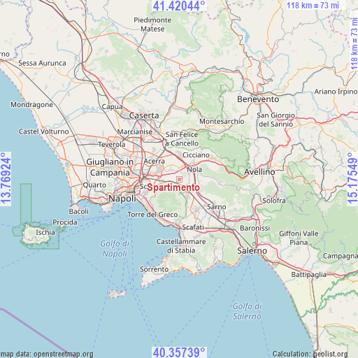
Spartimento GPS coordinates[2]
40° 53' 27.78" North, 14° 28' 20.496" East
| Map corner | latitude | longitude |
|---|---|---|
| Upper-left | 41.42044°, | 13.76924° |
| Center: | 40.89105°, | 14.47236° |
| Lower-right: | 40.35739°, | 15.17549° |
| Map W x H: | 118.2×118.2 km | = 73.4×73.4mi |
| max Lat: | 47.04031° ⇑80.1% North |
| Spartimento: | 40.89105° |
| min Lat: | ⇓19.9% South 35.50142° |
| min Long | Spartimento | max Long |
| 6.69888° | 14.47236° | 18.48682° |
| W 82.4%⇐ | ⇒17.6% E |
Elevation
Elevation of Spartimento is 59 m = 194 ft, and this is 247.7 m = 813 ft below average elevation for this country.
| Max E: |
2085 m = 6841 ft | 78.1% |
| Avg. | 306.7 m = 1006 ft | |
| Spartimento | 59 m = 194 ft | |
Min E: |
-4 m = -13 ft | 21.9% |
See also: Italy elevation on elevation.city.
Geographical zone
Spartimento is located in North temperate zone (between Tropic of Cancer and the Arctic Circle). Distance of this Northern Tropic circle is 1940.7 km =1205.9 mi to South.| Distance of | km | miles | from Spartimento |
|---|---|---|---|
| North Pole | 5460.4 | 3392.9 | to North |
| Arctic Circle | 2854.5 | 1773.7 | to North |
| Tropic Cancer | 1940.7 | 1205.9 | to South |
| Equator | 4546.7 | 2825.2 | to South |


Nearby cities:
15 places around Spartimento: (largest is in red/bold)
• Brusciano
5.4 km =3.4 mi,  310°
310°
• Castello di Cisterna
5.8 km =3.6 mi,  298°
298°
• Mariglianella
5.2 km =3.2 mi,  325°
325°
• Marigliano
4 km =2.5 mi,  340°
340°
• Nola
6.1 km =3.8 mi,  50°
50°
• Ottaviano
4.4 km =2.7 mi,  173°
173°
• Piazzola
3.1 km =1.9 mi,  131°
131°
• Piazzolla
3.7 km =2.3 mi,  92°
92°
• Pollastri
4.9 km =3 mi,  77°
77°
• San Gennaro Vesuviano
5.4 km =3.4 mi, 126°
• San Vitaliano
3.7 km =2.3 mi,  2°
2°
• Saviano
3.2 km =2 mi,  60°
60°
• Scisciano
1.7 km =1.1 mi,  5°
5°
• Somma Vesuviana
3.5 km =2.2 mi,  235°
235°
• Starza Vecchia
6 km =3.7 mi,  269°
269°
Sources, notices
• [Note1] Compared only with cities in Italy existing in our database
• [Src1] Map data: © OpenStreetMap contributors (CC-BY-SA)
• [Src2] Other city data from geonames.org with taken over terms of usage.
• [Src3] Geographical zone / Annual Mean Temperature by Robert A. Rohde @ Wikipedia
