Garbagnate geodata
Garbagnate (Lombardy) is a seat of a third-order administrative division; located in Italy in Europe/Rome (GMT+2) time zone. With population of 1,169 people, there are 6060 cities with bigger population in this country. Compared to other cities in Italy, 84.5% of cities are located further ↓South; 76.4% of cities are located further →East and 58.4% of cities have lower elevation than Garbagnate. Note1
Administrative division(s):
- Level 1: Lombardy
- Level 2: Provincia di Lecco
- Level 3: Garbagnate Monastero


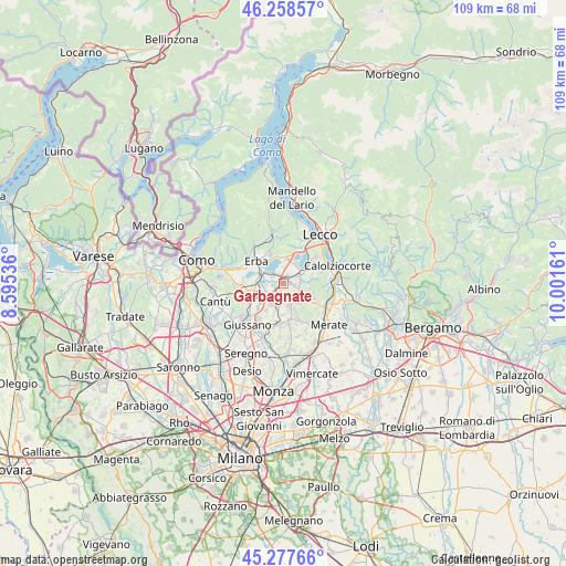
Garbagnate GPS coordinates[2]
45° 46' 12.972" North, 9° 17' 54.528" East
| Map corner | latitude | longitude |
|---|---|---|
| Upper-left | 46.25857°, | 8.59536° |
| Center: | 45.77027°, | 9.29848° |
| Lower-right: | 45.27766°, | 10.00161° |
| Map W x H: | 109.1×109.1 km | = 67.8×67.8mi |
| max Lat: | 47.04031° ⇑15.5% North |
| Garbagnate: | 45.77027° |
| min Lat: | ⇓84.5% South 35.50142° |
| min Long | Garbagnate | max Long |
| 6.69888° | 9.29848° | 18.48682° |
| W 23.6%⇐ | ⇒76.4% E |
Elevation
Elevation of Garbagnate is 288 m = 945 ft, and this is 18.7 m = 61 ft below average elevation for this country.
| Max E: |
2085 m = 6841 ft | 41.6% |
| Avg. | 306.7 m = 1006 ft | |
| Garbagnate | 288 m = 945 ft | |
Min E: |
-4 m = -13 ft | 58.4% |
See also: Italy elevation on elevation.city.
Geographical zone
Garbagnate is located in North temperate zone (between Tropic of Cancer and the Arctic Circle). Distance of this North polar circle is 2312 km =1436.6 mi to North.| Distance of | km | miles | from Garbagnate |
|---|---|---|---|
| North Pole | 4917.9 | 3055.8 | to North |
| Arctic Circle | 2312 | 1436.6 | to North |
| Tropic Cancer | 2483.3 | 1543.1 | to South |
| Equator | 5089.2 | 3162.3 | to South |


Nearby cities:
15 places around Garbagnate: (largest is in red/bold)
• Barzago
2 km =1.2 mi,  143°
143°
• Bosisio Parini
3.5 km =2.2 mi,  349°
349°
• Brongio
1.2 km =0.7 mi,  116°
116°
• Bulciago
2.4 km =1.5 mi,  204°
204°
• Camisasca
3.3 km =2.1 mi,  263°
263°
• Case Manzoni-Pascolo-Coroldo
2.1 km =1.3 mi,  17°
17°
• Costa Masnaga
1.7 km =1.1 mi,  267°
267°
• Cremella
3.5 km =2.2 mi,  177°
177°
• Dolzago
3.2 km =2 mi,  96°
96°
• Garbagnate Monastero
0.4 km =0.2 mi,  33°
33°
• Molteno
1 km =0.6 mi, 25°
• Nibionno
3.5 km =2.2 mi,  220°
220°
• Rogeno
2.3 km =1.4 mi,  305°
305°
• Sirone
1.9 km =1.2 mi,  81°
81°
• Tabiago-Cibrone
2.9 km =1.8 mi,  237°
237°
Sources, notices
• [Note1] Compared only with cities in Italy existing in our database
• [Src1] Map data: © OpenStreetMap contributors (CC-BY-SA)
• [Src2] Other city data from geonames.org with taken over terms of usage.
• [Src3] Geographical zone / Annual Mean Temperature by Robert A. Rohde @ Wikipedia
