Prepezzano geodata
Prepezzano (Campania) is a populated place; located in Italy in Europe/Rome (GMT+2) time zone. With population of 1,075 people, there are 6386 cities with bigger population in this country. Compared to other cities in Italy, 82.2% of cities are located further ↑North; 86.3% of cities are located further ←West and 57.6% of cities have higher elevation than Prepezzano. Note1
Administrative division(s):
- Level 1: Campania
- Level 2: Provincia di Salerno
- Level 3: Giffoni Sei Casali


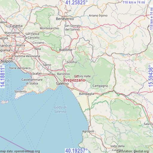
Prepezzano GPS coordinates[2]
40° 43' 39.144" North, 14° 53' 28.428" East
| Map corner | latitude | longitude |
|---|---|---|
| Upper-left | 41.25825°, | 14.18811° |
| Center: | 40.72754°, | 14.89123° |
| Lower-right: | 40.19257°, | 15.59436° |
| Map W x H: | 118.5×118.5 km | = 73.6×73.6mi |
| max Lat: | 47.04031° ⇑82.2% North |
| Prepezzano: | 40.72754° |
| min Lat: | ⇓17.8% South 35.50142° |
| min Long | Prepezzano | max Long |
| 6.69888° | 14.89123° | 18.48682° |
| W 86.3%⇐ | ⇒13.7% E |
Elevation
Elevation of Prepezzano is 183 m = 600 ft, and this is 123.7 m = 406 ft below average elevation for this country.
| Max E: |
2085 m = 6841 ft | 57.6% |
| Avg. | 306.7 m = 1006 ft | |
| Prepezzano | 183 m = 600 ft | |
Min E: |
-4 m = -13 ft | 42.4% |
See also: Italy elevation on elevation.city.
Geographical zone
Prepezzano is located in North temperate zone (between Tropic of Cancer and the Arctic Circle). Distance of this Northern Tropic circle is 1922.6 km =1194.6 mi to South.| Distance of | km | miles | from Prepezzano |
|---|---|---|---|
| North Pole | 5478.6 | 3404.2 | to North |
| Arctic Circle | 2872.7 | 1785 | to North |
| Tropic Cancer | 1922.6 | 1194.6 | to South |
| Equator | 4528.5 | 2813.9 | to South |


Nearby cities:
15 places around Prepezzano: (largest is in red/bold)
• Campigliano
5.2 km =3.2 mi,  197°
197°
• Capitignano
1.5 km =0.9 mi,  131°
131°
• Castiglione del Genovesi
3.7 km =2.3 mi,  263°
263°
• Curti
3.6 km =2.2 mi,  44°
44°
• Gauro
6.3 km =3.9 mi,  103°
103°
• Giffoni Valle Piana
4.4 km =2.7 mi, 103°
• Malche-Santa Croce-Serroni
2.4 km =1.5 mi,  147°
147°
• Mercato
4.3 km =2.7 mi,  107°
107°
• Montecorvino Pugliano
7 km =4.3 mi,  139°
139°
• Pezzano-Filetta
3.8 km =2.4 mi,  208°
208°
• San Cipriano Picentino
1.8 km =1.1 mi,  242°
242°
• San Giovanni-Santa Caterina
3.5 km =2.2 mi,  65°
65°
• San Mango Piemonte
5.3 km =3.3 mi, 235°
• Santa Tecla-Castelpagano
6.4 km =4 mi,  159°
159°
• Sieti
1.9 km =1.2 mi,  30°
30°
Sources, notices
• [Note1] Compared only with cities in Italy existing in our database
• [Src1] Map data: © OpenStreetMap contributors (CC-BY-SA)
• [Src2] Other city data from geonames.org with taken over terms of usage.
• [Src3] Geographical zone / Annual Mean Temperature by Robert A. Rohde @ Wikipedia
