Pezzano-Filetta geodata
Pezzano-Filetta (Campania) is a populated place; located in Italy in Europe/Rome (GMT+2) time zone. With population of 2,434 people, there are 3604 cities with bigger population in this country. Compared to other cities in Italy, 82.5% of cities are located further ↑North; 86.1% of cities are located further ←West and 50.7% of cities have lower elevation than Pezzano-Filetta. Note1
Administrative division(s):
- Level 1: Campania
- Level 2: Provincia di Salerno
- Level 3: San Cipriano Picentino


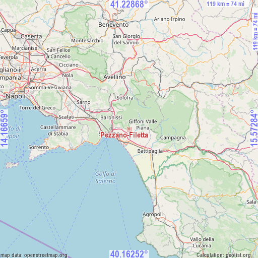
Pezzano-Filetta GPS coordinates[2]
40° 41' 51.828" North, 14° 52' 10.956" East
| Map corner | latitude | longitude |
|---|---|---|
| Upper-left | 41.22868°, | 14.16659° |
| Center: | 40.69773°, | 14.86971° |
| Lower-right: | 40.16252°, | 15.57284° |
| Map W x H: | 118.5×118.5 km | = 73.6×73.6mi |
| max Lat: | 47.04031° ⇑82.5% North |
| Pezzano-Filetta: | 40.69773° |
| min Lat: | ⇓17.5% South 35.50142° |
| min Long | Pezzano-Filetta | max Long |
| 6.69888° | 14.86971° | 18.48682° |
| W 86.1%⇐ | ⇒13.9% E |
Elevation
Elevation of Pezzano-Filetta is 239 m = 784 ft, and this is 67.7 m = 222 ft below average elevation for this country.
| Max E: |
2085 m = 6841 ft | 49.3% |
| Avg. | 306.7 m = 1006 ft | |
| Pezzano-Filetta | 239 m = 784 ft | |
Min E: |
-4 m = -13 ft | 50.7% |
See also: Italy elevation on elevation.city.
Geographical zone
Pezzano-Filetta is located in North temperate zone (between Tropic of Cancer and the Arctic Circle). Distance of this Northern Tropic circle is 1919.2 km =1192.5 mi to South.| Distance of | km | miles | from Pezzano-Filetta |
|---|---|---|---|
| North Pole | 5481.9 | 3406.3 | to North |
| Arctic Circle | 2876 | 1787.1 | to North |
| Tropic Cancer | 1919.2 | 1192.5 | to South |
| Equator | 4525.2 | 2811.8 | to South |


Nearby cities:
15 places around Pezzano-Filetta: (largest is in red/bold)
• Campigliano
1.7 km =1.1 mi,  170°
170°
• Capitignano
3.7 km =2.3 mi,  51°
51°
• Casa Rocco d'Amato
3.8 km =2.4 mi,  238°
238°
• Castiglione del Genovesi
3.4 km =2.1 mi,  327°
327°
• Faiano
4.8 km =3 mi,  144°
144°
• Giffoni Valle Piana
6.5 km =4 mi,  69°
69°
• Malche-Santa Croce-Serroni
3.4 km =2.1 mi, 67°
• Mercato
6.3 km =3.9 mi, 70°
• Piegolelle-San Bartolomeo
4.1 km =2.5 mi,  251°
251°
• Pontecagnano
5.9 km =3.7 mi, 174°
• Prepezzano
3.8 km =2.4 mi,  28°
28°
• San Cipriano Picentino
2.5 km =1.6 mi,  4°
4°
• San Mango Piemonte
2.6 km =1.6 mi,  276°
276°
• Santa Tecla-Castelpagano
4.9 km =3 mi,  123°
123°
• Sieti
5.7 km =3.5 mi, 29°
Sources, notices
• [Note1] Compared only with cities in Italy existing in our database
• [Src1] Map data: © OpenStreetMap contributors (CC-BY-SA)
• [Src2] Other city data from geonames.org with taken over terms of usage.
• [Src3] Geographical zone / Annual Mean Temperature by Robert A. Rohde @ Wikipedia
