Calnova-Fiorentina geodata
Calnova-Fiorentina (Veneto) is a populated place; located in Italy in Europe/Rome (GMT+2) time zone. With population of 961 people, there are 6815 cities with bigger population in this country. Compared to other cities in Italy, 78.5% of cities are located further ↓South; 63.7% of cities are located further ←West and 99.8% of cities have higher elevation than Calnova-Fiorentina. Note1
Administrative division(s):
- Level 1: Veneto
- Level 2: Provincia di Venezia
- Level 3: San Donà di Piave


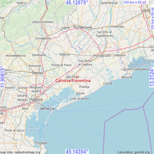
Calnova-Fiorentina GPS coordinates[2]
45° 38' 14.352" North, 12° 36' 33.372" East
| Map corner | latitude | longitude |
|---|---|---|
| Upper-left | 46.12679°, | 11.90615° |
| Center: | 45.63732°, | 12.60927° |
| Lower-right: | 45.14354°, | 13.3124° |
| Map W x H: | 109.3×109.3 km | = 67.9×67.9mi |
| max Lat: | 47.04031° ⇑21.5% North |
| Calnova-Fiorentina: | 45.63732° |
| min Lat: | ⇓78.5% South 35.50142° |
| min Long | Calnova-Fiorent | max Long |
| 6.69888° | 12.60927° | 18.48682° |
| W 63.7%⇐ | ⇒36.3% E |
Elevation
Elevation of Calnova-Fiorentina is -1 m = -3 ft, and this is 307.7 m = 1010 ft below average elevation for this country.
| Max E: |
2085 m = 6841 ft | 99.8% |
| Avg. | 306.7 m = 1006 ft | |
| Calnova-Fiorentina | -1 m = -3 ft | |
Min E: |
-4 m = -13 ft | 0.2% |
See also: Italy elevation on elevation.city.
Geographical zone
Calnova-Fiorentina is located in North temperate zone (between Tropic of Cancer and the Arctic Circle). Distance of this North polar circle is 2326.8 km =1445.8 mi to North.| Distance of | km | miles | from Calnova-Fiorentina |
|---|---|---|---|
| North Pole | 4932.7 | 3065 | to North |
| Arctic Circle | 2326.8 | 1445.8 | to North |
| Tropic Cancer | 2468.5 | 1533.9 | to South |
| Equator | 5074.4 | 3153.1 | to South |


Nearby cities:
15 places around Calnova-Fiorentina: (largest is in red/bold)
• Campobernardo
8 km =5 mi,  316°
316°
• Ceggia
6.1 km =3.8 mi,  24°
24°
• Cessalto
8.5 km =5.3 mi,  1°
1°
• Chiesanuova
4.9 km =3 mi,  208°
208°
• Crepaldo
8.3 km =5.2 mi,  124°
124°
• Croce
6.8 km =4.2 mi,  265°
265°
• Eraclea
8.3 km =5.2 mi,  143°
143°
• Fossalta di Piave
7.8 km =4.8 mi,  276°
276°
• Musile di Piave
5.6 km =3.5 mi,  250°
250°
• Noventa di Piave
6.4 km =4 mi,  292°
292°
• Passarella
4.8 km =3 mi,  183°
183°
• San Donà di Piave
3.3 km =2.1 mi,  256°
256°
• Santa Maria di Campagna
7.3 km =4.5 mi,  353°
353°
• Stretti
6.1 km =3.8 mi,  90°
90°
• Torre di Mosto
8.9 km =5.5 mi,  52°
52°
Sources, notices
• [Note1] Compared only with cities in Italy existing in our database
• [Src1] Map data: © OpenStreetMap contributors (CC-BY-SA)
• [Src2] Other city data from geonames.org with taken over terms of usage.
• [Src3] Geographical zone / Annual Mean Temperature by Robert A. Rohde @ Wikipedia
