Chiesuola geodata
Chiesuola (Latium) is a populated place; located in Italy in Europe/Rome (GMT+2) time zone. With population of 802 people, there are 7635 cities with bigger population in this country. Compared to other cities in Italy, 74.8% of cities are located further ↑North; 67.2% of cities are located further ←West and 90.6% of cities have higher elevation than Chiesuola. Note1


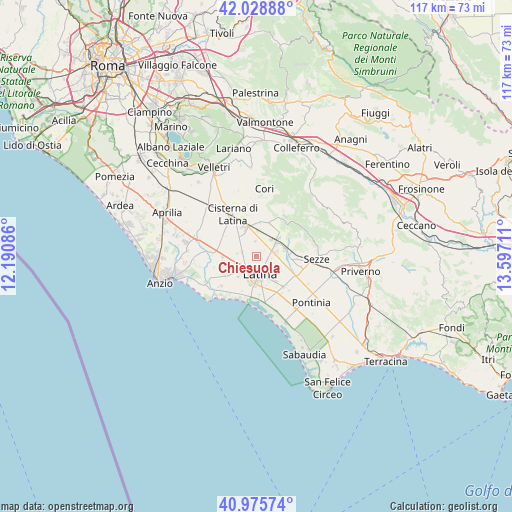
Chiesuola GPS coordinates[2]
41° 30' 16.02" North, 12° 53' 38.328" East
| Map corner | latitude | longitude |
|---|---|---|
| Upper-left | 42.02888°, | 12.19086° |
| Center: | 41.50445°, | 12.89398° |
| Lower-right: | 40.97574°, | 13.59711° |
| Map W x H: | 117.1×117.1 km | = 72.8×72.8mi |
| max Lat: | 47.04031° ⇑74.8% North |
| Chiesuola: | 41.50445° |
| min Lat: | ⇓25.2% South 35.50142° |
| min Long | Chiesuola | max Long |
| 6.69888° | 12.89398° | 18.48682° |
| W 67.2%⇐ | ⇒32.8% E |
Elevation
Elevation of Chiesuola is 17 m = 56 ft, and this is 289.7 m = 950 ft below average elevation for this country.
| Max E: |
2085 m = 6841 ft | 90.6% |
| Avg. | 306.7 m = 1006 ft | |
| Chiesuola | 17 m = 56 ft | |
Min E: |
-4 m = -13 ft | 9.4% |
See also: Italy elevation on elevation.city.
Geographical zone
Chiesuola is located in North temperate zone (between Tropic of Cancer and the Arctic Circle). Distance of this Northern Tropic circle is 2008.9 km =1248.3 mi to South.| Distance of | km | miles | from Chiesuola |
|---|---|---|---|
| North Pole | 5392.2 | 3350.6 | to North |
| Arctic Circle | 2786.3 | 1731.3 | to North |
| Tropic Cancer | 2008.9 | 1248.3 | to South |
| Equator | 4614.9 | 2867.6 | to South |


Nearby cities:
15 places around Chiesuola: (largest is in red/bold)
• Borgo Bainsizza
8.7 km =5.4 mi,  254°
254°
• Borgo Carso
3.4 km =2.1 mi,  352°
352°
• Borgo Faiti
9.8 km =6.1 mi,  115°
115°
• Borgo Flora
7.3 km =4.5 mi,  313°
313°
• Borgo Piave
3.6 km =2.2 mi,  226°
226°
• Borgo Podgora
3.5 km =2.2 mi,  288°
288°
• Borgo Santa Maria
9.3 km =5.8 mi,  239°
239°
• Carrara-Pontenuovo
6.4 km =4 mi,  51°
51°
• Crocefisso
7 km =4.3 mi, 232°
• Farneto
6.3 km =3.9 mi,  220°
220°
• Latina
4.3 km =2.7 mi,  168°
168°
• Latina Scalo
5.3 km =3.3 mi, 54°
• Monticchio
7.9 km =4.9 mi,  59°
59°
• Prato di Coppola
9.7 km =6 mi,  186°
186°
• Sermoneta
9.1 km =5.7 mi, 56°
Sources, notices
• [Note1] Compared only with cities in Italy existing in our database
• [Src1] Map data: © OpenStreetMap contributors (CC-BY-SA)
• [Src2] Other city data from geonames.org with taken over terms of usage.
• [Src3] Geographical zone / Annual Mean Temperature by Robert A. Rohde @ Wikipedia
