Tre Pontoni geodata
Tre Pontoni (Latium) is a populated place; located in Italy in Europe/Rome (GMT+2) time zone. With population of 777 people, there are 7779 cities with bigger population in this country. Compared to other cities in Italy, 69.4% of cities are located further ↑North; 63.1% of cities are located further ←West and 72.3% of cities have higher elevation than Tre Pontoni. Note1
Administrative division(s):
- Level 1: Latium
- Level 2: Città metropolitana di Roma Capitale
- Level 3: Castelnuovo di Porto


Tre Pontoni GPS coordinates[2]
42° 6' 15.048" North, 12° 33' 54.576" East
| Map corner | latitude | longitude |
|---|---|---|
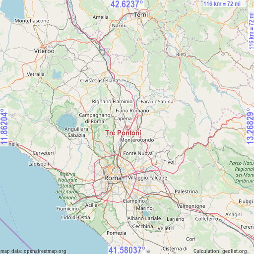
| Upper-left | 42.6237°, | 11.86204° |
| Center: | 42.10418°, | 12.56516° |
| Lower-right: | 41.58037°, | 13.26829° |
| Map W x H: | 116×116 km | = 72.1×72.1mi |
| max Lat: | 47.04031° ⇑69.4% North |
| Tre Pontoni: | 42.10418° |
| min Lat: | ⇓30.6% South 35.50142° |
| min Long | Tre Pontoni | max Long |
| 6.69888° | 12.56516° | 18.48682° |
| W 63.1%⇐ | ⇒36.9% E |
Elevation
Elevation of Tre Pontoni is 86 m = 282 ft, and this is 220.7 m = 724 ft below average elevation for this country.
| Max E: |
2085 m = 6841 ft | 72.3% |
| Avg. | 306.7 m = 1006 ft | |
| Tre Pontoni | 86 m = 282 ft | |
Min E: |
-4 m = -13 ft | 27.7% |
See also: Italy elevation on elevation.city.
Geographical zone
Tre Pontoni is located in North temperate zone (between Tropic of Cancer and the Arctic Circle). Distance of this Northern Tropic circle is 2075.6 km =1289.7 mi to South.| Distance of | km | miles | from Tre Pontoni |
|---|---|---|---|
| North Pole | 5325.5 | 3309.1 | to North |
| Arctic Circle | 2719.6 | 1689.9 | to North |
| Tropic Cancer | 2075.6 | 1289.7 | to South |
| Equator | 4681.5 | 2908.9 | to South |


Nearby cities:
15 places around Tre Pontoni: (largest is in red/bold)
• Bivio di Capanelle
2.9 km =1.8 mi,  54°
54°
• Capena
4.6 km =2.9 mi,  338°
338°
• Castelnuovo di Porto
5 km =3.1 mi,  294°
294°
• Colle del Fagiano
1.3 km =0.8 mi, 293°
• Costaroni
3.7 km =2.3 mi,  218°
218°
• Fiano Romano
6.2 km =3.9 mi,  23°
23°
• Girardi-Bellavista-Terrazze
1.2 km =0.7 mi,  98°
98°
• Mentana
10 km =6.2 mi,  139°
139°
• Monte Caminetto
8.6 km =5.3 mi,  240°
240°
• Montelarco
9.4 km =5.8 mi,  314°
314°
• Monterotondo
7.4 km =4.6 mi, 142°
• Morlupo
7.2 km =4.5 mi, 314°
• Riano
4.3 km =2.7 mi,  254°
254°
• Sacrofano
9.7 km =6 mi,  270°
270°
• San Martino-Sant'Anzino
4.7 km =2.9 mi,  125°
125°
Sources, notices
• [Note1] Compared only with cities in Italy existing in our database
• [Src1] Map data: © OpenStreetMap contributors (CC-BY-SA)
• [Src2] Other city data from geonames.org with taken over terms of usage.
• [Src3] Geographical zone / Annual Mean Temperature by Robert A. Rohde @ Wikipedia
