Olza-Fogarole geodata
Olza-Fogarole (Emilia-Romagna) is a populated place; located in Italy in Europe/Rome (GMT+2) time zone. With population of 549 people, there are 9458 cities with bigger population in this country. Compared to other cities in Italy, 62.5% of cities are located further ↓South; 68.2% of cities are located further →East and 82.9% of cities have higher elevation than Olza-Fogarole. Note1
Administrative division(s):
- Level 1: Emilia-Romagna
- Level 2: Provincia di Piacenza
- Level 3: Monticelli d'Ongina


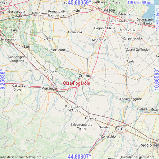
Olza-Fogarole GPS coordinates[2]
45° 6' 23.364" North, 9° 57' 45" East
| Map corner | latitude | longitude |
|---|---|---|
| Upper-left | 45.60059°, | 9.25938° |
| Center: | 45.10649°, | 9.9625° |
| Lower-right: | 44.60807°, | 10.66563° |
| Map W x H: | 110.4×110.4 km | = 68.6×68.6mi |
| max Lat: | 47.04031° ⇑37.5% North |
| Olza-Fogarole: | 45.10649° |
| min Lat: | ⇓62.5% South 35.50142° |
| min Long | Olza-Fogarole | max Long |
| 6.69888° | 9.9625° | 18.48682° |
| W 31.8%⇐ | ⇒68.2% E |
Elevation
Elevation of Olza-Fogarole is 38 m = 125 ft, and this is 268.7 m = 882 ft below average elevation for this country.
| Max E: |
2085 m = 6841 ft | 82.9% |
| Avg. | 306.7 m = 1006 ft | |
| Olza-Fogarole | 38 m = 125 ft | |
Min E: |
-4 m = -13 ft | 17.1% |
See also: Italy elevation on elevation.city.
Geographical zone
Olza-Fogarole is located in North temperate zone (between Tropic of Cancer and the Arctic Circle). Distance of this North polar circle is 2385.8 km =1482.5 mi to North.| Distance of | km | miles | from Olza-Fogarole |
|---|---|---|---|
| North Pole | 4991.7 | 3101.7 | to North |
| Arctic Circle | 2385.8 | 1482.5 | to North |
| Tropic Cancer | 2409.5 | 1497.2 | to South |
| Equator | 5015.4 | 3116.4 | to South |


Nearby cities:
15 places around Olza-Fogarole: (largest is in red/bold)
• Battaglione-Bagnara
8.3 km =5.2 mi,  82°
82°
• Boschetto
8.3 km =5.2 mi,  37°
37°
• Bosco Ex Parmigiano
6 km =3.7 mi,  89°
89°
• Casanova del Morbasco
6.3 km =3.9 mi,  0°
0°
• Castelnuovo Bocca d'Adda
7.8 km =4.8 mi,  274°
274°
• Castelvetro Piacentino
2.2 km =1.4 mi,  102°
102°
• Costa Sant'Abramo
6.7 km =4.2 mi, 2°
• Cremona
5.5 km =3.4 mi,  57°
57°
• Gerre de' Caprioli
7.2 km =4.5 mi, 104°
• Maristella
8.6 km =5.3 mi, 55°
• Monticelli d'Ongina
3 km =1.9 mi,  227°
227°
• San Giuliano
4.8 km =3 mi,  148°
148°
• San Nazzaro
6 km =3.7 mi,  236°
236°
• Sesto Cremonese
8.6 km =5.3 mi,  333°
333°
• Spinadesco
5.5 km =3.4 mi, 329°
Sources, notices
• [Note1] Compared only with cities in Italy existing in our database
• [Src1] Map data: © OpenStreetMap contributors (CC-BY-SA)
• [Src2] Other city data from geonames.org with taken over terms of usage.
• [Src3] Geographical zone / Annual Mean Temperature by Robert A. Rohde @ Wikipedia
