Pratolungo geodata
Pratolungo (Latium) is a populated place; located in Italy in Europe/Rome (GMT+2) time zone. With population of 502 people, there are 9915 cities with bigger population in this country. Compared to other cities in Italy, 70.7% of cities are located further ↑North; 63.8% of cities are located further ←West and 80.9% of cities have higher elevation than Pratolungo. Note1
Administrative division(s):
- Level 1: Latium
- Level 2: Città metropolitana di Roma Capitale
- Level 3: Roma Capitale
- Level 4: Municipio Roma IV


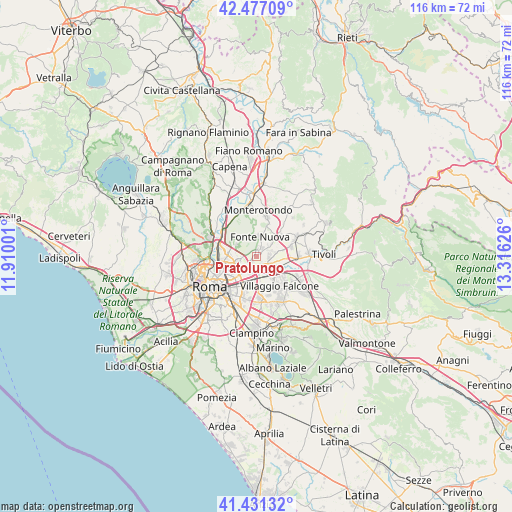
Pratolungo GPS coordinates[2]
41° 57' 22.86" North, 12° 36' 47.268" East
| Map corner | latitude | longitude |
|---|---|---|
| Upper-left | 42.47709°, | 11.91001° |
| Center: | 41.95635°, | 12.61313° |
| Lower-right: | 41.43132°, | 13.31626° |
| Map W x H: | 116.3×116.3 km | = 72.3×72.3mi |
| max Lat: | 47.04031° ⇑70.7% North |
| Pratolungo: | 41.95635° |
| min Lat: | ⇓29.3% South 35.50142° |
| min Long | Pratolungo | max Long |
| 6.69888° | 12.61313° | 18.48682° |
| W 63.8%⇐ | ⇒36.2% E |
Elevation
Elevation of Pratolungo is 46 m = 151 ft, and this is 260.7 m = 855 ft below average elevation for this country.
| Max E: |
2085 m = 6841 ft | 80.9% |
| Avg. | 306.7 m = 1006 ft | |
| Pratolungo | 46 m = 151 ft | |
Min E: |
-4 m = -13 ft | 19.1% |
See also: Italy elevation on elevation.city.
Geographical zone
Pratolungo is located in North temperate zone (between Tropic of Cancer and the Arctic Circle). Distance of this Northern Tropic circle is 2059.2 km =1279.5 mi to South.| Distance of | km | miles | from Pratolungo |
|---|---|---|---|
| North Pole | 5342 | 3319.4 | to North |
| Arctic Circle | 2736.1 | 1700.1 | to North |
| Tropic Cancer | 2059.2 | 1279.5 | to South |
| Equator | 4665.1 | 2898.8 | to South |


Nearby cities:
15 places around Pratolungo: (largest is in red/bold)
• Albuccione
7.1 km =4.4 mi,  93°
93°
• Andreuzza
8.5 km =5.3 mi,  43°
43°
• Bagni di Tivoli
8.6 km =5.3 mi, 94°
• Colle Monfortani
7.5 km =4.7 mi,  156°
156°
• Colle Verde
2.3 km =1.4 mi,  11°
11°
• Colleverde II
2.6 km =1.6 mi, 36°
• Forno Casale
2.3 km =1.4 mi,  118°
118°
• Laghetto
3.8 km =2.4 mi,  71°
71°
• Marco Simone
2.9 km =1.8 mi, 92°
• Mentana
9.2 km =5.7 mi,  16°
16°
• Pichini
7.6 km =4.7 mi,  48°
48°
• Prato Lauro
1.4 km =0.9 mi,  322°
322°
• Santa Lucia
4.6 km =2.9 mi, 50°
• Setteville
3.4 km =2.1 mi,  113°
113°
• Tor Lupara
4.6 km =2.9 mi, 5°
Sources, notices
• [Note1] Compared only with cities in Italy existing in our database
• [Src1] Map data: © OpenStreetMap contributors (CC-BY-SA)
• [Src2] Other city data from geonames.org with taken over terms of usage.
• [Src3] Geographical zone / Annual Mean Temperature by Robert A. Rohde @ Wikipedia
