Serone geodata
Serone (Lombardy) is a seat of a third-order administrative division; located in Italy in Europe/Rome (GMT+2) time zone. With population of 71 people, there are 11534 cities with bigger population in this country. Compared to other cities in Italy, 95.1% of cities are located further ↓South; 72.2% of cities are located further →East and 90.1% of cities have lower elevation than Serone. Note1


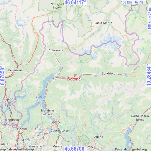
Serone GPS coordinates[2]
46° 9' 22.572" North, 9° 34' 54.156" East
| Map corner | latitude | longitude |
|---|---|---|
| Upper-left | 46.64117°, | 8.87858° |
| Center: | 46.15627°, | 9.58171° |
| Lower-right: | 45.66706°, | 10.28484° |
| Map W x H: | 108.3×108.3 km | = 67.3×67.3mi |
| max Lat: | 47.04031° ⇑4.9% North |
| Serone: | 46.15627° |
| min Lat: | ⇓95.1% South 35.50142° |
| min Long | Serone | max Long |
| 6.69888° | 9.58171° | 18.48682° |
| W 27.8%⇐ | ⇒72.2% E |
Elevation
Elevation of Serone is 724 m = 2375 ft, and this is 417.3 m = 1369 ft above average elevation for this country.
| Max E: |
2085 m = 6841 ft | 9.9% |
| Serone | 724 m 2375 ft | |
| Avg. | 306.7 m = 1006 ft | |
Min E: |
-4 m = -13 ft | 90.1% |
See also: Italy elevation on elevation.city.
Geographical zone
Serone is located in North temperate zone (between Tropic of Cancer and the Arctic Circle). Distance of this North polar circle is 2269.1 km =1410 mi to North.| Distance of | km | miles | from Serone |
|---|---|---|---|
| North Pole | 4875 | 3029.2 | to North |
| Arctic Circle | 2269.1 | 1410 | to North |
| Tropic Cancer | 2526.2 | 1569.7 | to South |
| Equator | 5132.1 | 3188.9 | to South |


Nearby cities:
15 places around Serone: (largest is in red/bold)
• Albaredo
6 km =3.7 mi,  173°
173°
• Ardenno
5.2 km =3.2 mi,  76°
76°
• Bema
5.5 km =3.4 mi,  194°
194°
• Campovico
1.3 km =0.8 mi,  151°
151°
• Cercino
5.7 km =3.5 mi,  272°
272°
• Cosio Valtellino
3.3 km =2.1 mi,  224°
224°
• Dazio
1.6 km =1 mi,  69°
69°
• Forcola
6.1 km =3.8 mi,  87°
87°
• Mello
2.7 km =1.7 mi, 266°
• Morbegno
2.2 km =1.4 mi,  195°
195°
• Piussogno
5.8 km =3.6 mi, 265°
• Regoledo
3.8 km =2.4 mi,  227°
227°
• Sirta
6.1 km =3.8 mi, 87°
• Talamona
3.1 km =1.9 mi,  129°
129°
• Traona
3.9 km =2.4 mi,  255°
255°
Sources, notices
• [Note1] Compared only with cities in Italy existing in our database
• [Src1] Map data: © OpenStreetMap contributors (CC-BY-SA)
• [Src2] Other city data from geonames.org with taken over terms of usage.
• [Src3] Geographical zone / Annual Mean Temperature by Robert A. Rohde @ Wikipedia
