Albaredo geodata
Albaredo (Lombardy) is a seat of a third-order administrative division; located in Italy in Europe/Rome (GMT+2) time zone. With population of 349 people, there are 10483 cities with bigger population in this country. Compared to other cities in Italy, 94.1% of cities are located further ↓South; 72.1% of cities are located further →East and 95.9% of cities have lower elevation than Albaredo. Note1
Administrative division(s):
- Level 1: Lombardy
- Level 2: Provincia di Sondrio
- Level 3: Albaredo per San Marco


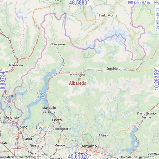
Albaredo GPS coordinates[2]
46° 6' 10.548" North, 9° 35' 25.656" East
| Map corner | latitude | longitude |
|---|---|---|
| Upper-left | 46.5883°, | 8.88734° |
| Center: | 46.10293°, | 9.59046° |
| Lower-right: | 45.61325°, | 10.29359° |
| Map W x H: | 108.4×108.4 km | = 67.4×67.4mi |
| max Lat: | 47.04031° ⇑5.9% North |
| Albaredo: | 46.10293° |
| min Lat: | ⇓94.1% South 35.50142° |
| min Long | Albaredo | max Long |
| 6.69888° | 9.59046° | 18.48682° |
| W 27.9%⇐ | ⇒72.1% E |
Elevation
Elevation of Albaredo is 928 m = 3045 ft, and this is 621.3 m = 2038 ft above average elevation for this country.
| Max E: |
2085 m = 6841 ft | 4.1% |
| Albaredo | 928 m 3045 ft | |
| Avg. | 306.7 m = 1006 ft | |
Min E: |
-4 m = -13 ft | 95.9% |
See also: Italy elevation on elevation.city.
Geographical zone
Albaredo is located in North temperate zone (between Tropic of Cancer and the Arctic Circle). Distance of this North polar circle is 2275 km =1413.6 mi to North.| Distance of | km | miles | from Albaredo |
|---|---|---|---|
| North Pole | 4880.9 | 3032.8 | to North |
| Arctic Circle | 2275 | 1413.6 | to North |
| Tropic Cancer | 2520.2 | 1566 | to South |
| Equator | 5126.2 | 3185.3 | to South |


Nearby cities:
15 places around Albaredo: (largest is in red/bold)
• Bema
2.1 km =1.3 mi,  286°
286°
• Campovico
4.8 km =3 mi,  359°
359°
• Cosio Valtellino
4.7 km =2.9 mi,  320°
320°
• Dazio
6.5 km =4 mi,  6°
6°
• Forcola
8.2 km =5.1 mi,  41°
41°
• Gerola Alta
5.7 km =3.5 mi,  213°
213°
• Mello
6.7 km =4.2 mi,  330°
330°
• Morbegno
4 km =2.5 mi,  341°
341°
• Pedesina
3.9 km =2.4 mi,  233°
233°
• Rasura
2.9 km =1.8 mi,  264°
264°
• Regoledo
4.8 km =3 mi,  314°
314°
• Serone
6 km =3.7 mi,  353°
353°
• Talamona
4.3 km =2.7 mi,  23°
23°
• Tartano
6.8 km =4.2 mi,  87°
87°
• Traona
6.7 km =4.2 mi, 317°
In other languages:
- In France: Albaredo per San Marco
- In German: Albaredo per San Marco
- In Italian: Albaredo per San Marco
Sources, notices
• [Note1] Compared only with cities in Italy existing in our database
• [Src1] Map data: © OpenStreetMap contributors (CC-BY-SA)
• [Src2] Other city data from geonames.org with taken over terms of usage.
• [Src3] Geographical zone / Annual Mean Temperature by Robert A. Rohde @ Wikipedia
