Bema geodata
Bema (Lombardy) is a seat of a third-order administrative division; located in Italy in Europe/Rome (GMT+2) time zone. With population of 136 people, there are 11329 cities with bigger population in this country. Compared to other cities in Italy, 94.2% of cities are located further ↓South; 72.5% of cities are located further →East and 92.9% of cities have lower elevation than Bema. Note1


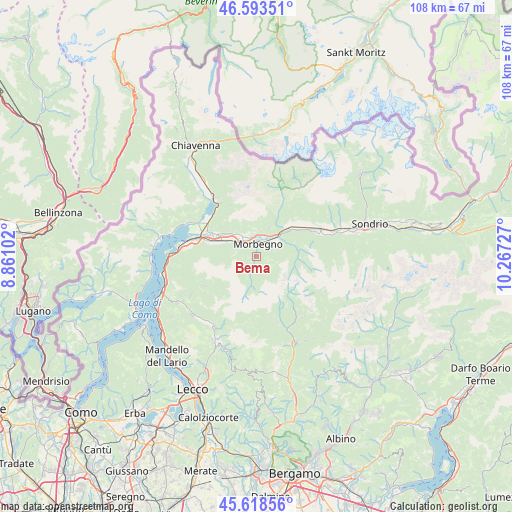
Bema GPS coordinates[2]
46° 6' 29.484" North, 9° 33' 50.904" East
| Map corner | latitude | longitude |
|---|---|---|
| Upper-left | 46.59351°, | 8.86102° |
| Center: | 46.10819°, | 9.56414° |
| Lower-right: | 45.61856°, | 10.26727° |
| Map W x H: | 108.4×108.4 km | = 67.4×67.4mi |
| max Lat: | 47.04031° ⇑5.8% North |
| Bema: | 46.10819° |
| min Lat: | ⇓94.2% South 35.50142° |
| min Long | Bema | max Long |
| 6.69888° | 9.56414° | 18.48682° |
| W 27.5%⇐ | ⇒72.5% E |
Elevation
Elevation of Bema is 795 m = 2608 ft, and this is 488.3 m = 1602 ft above average elevation for this country.
| Max E: |
2085 m = 6841 ft | 7.1% |
| Bema | 795 m 2608 ft | |
| Avg. | 306.7 m = 1006 ft | |
Min E: |
-4 m = -13 ft | 92.9% |
See also: Italy elevation on elevation.city.
Geographical zone
Bema is located in North temperate zone (between Tropic of Cancer and the Arctic Circle). Distance of this North polar circle is 2274.4 km =1413.2 mi to North.| Distance of | km | miles | from Bema |
|---|---|---|---|
| North Pole | 4880.3 | 3032.5 | to North |
| Arctic Circle | 2274.4 | 1413.2 | to North |
| Tropic Cancer | 2520.8 | 1566.4 | to South |
| Equator | 5126.8 | 3185.6 | to South |


Nearby cities:
15 places around Bema: (largest is in red/bold)
• Albaredo
2.1 km =1.3 mi,  106°
106°
• Campovico
4.6 km =2.9 mi,  25°
25°
• Cosio Valtellino
3.1 km =1.9 mi,  342°
342°
• Dazio
6.5 km =4 mi, 25°
• Gerola Alta
5.5 km =3.4 mi,  191°
191°
• Mello
5.4 km =3.4 mi,  346°
346°
• Morbegno
3.3 km =2.1 mi,  13°
13°
• Pedesina
3.1 km =1.9 mi,  201°
201°
• Piussogno
6.6 km =4.1 mi,  317°
317°
• Rasura
1.2 km =0.7 mi,  226°
226°
• Regoledo
3.1 km =1.9 mi,  333°
333°
• Rogolo
6.9 km =4.3 mi,  297°
297°
• Serone
5.5 km =3.4 mi, 14°
• Talamona
5 km =3.1 mi,  48°
48°
• Traona
5 km =3.1 mi, 330°
Sources, notices
• [Note1] Compared only with cities in Italy existing in our database
• [Src1] Map data: © OpenStreetMap contributors (CC-BY-SA)
• [Src2] Other city data from geonames.org with taken over terms of usage.
• [Src3] Geographical zone / Annual Mean Temperature by Robert A. Rohde @ Wikipedia
