Villa-Borgo geodata
Villa-Borgo (Piedmont) is a seat of a third-order administrative division; located in Italy in Europe/Rome (GMT+2) time zone. With population of 743 people, there are 7998 cities with bigger population in this country. Compared to other cities in Italy, 54.2% of cities are located further ↓South; 94.4% of cities are located further →East and 54.7% of cities have lower elevation than Villa-Borgo. Note1
Administrative division(s):
- Level 1: Piedmont
- Level 2: Provincia di Cuneo
- Level 3: Santa Vittoria d'Alba


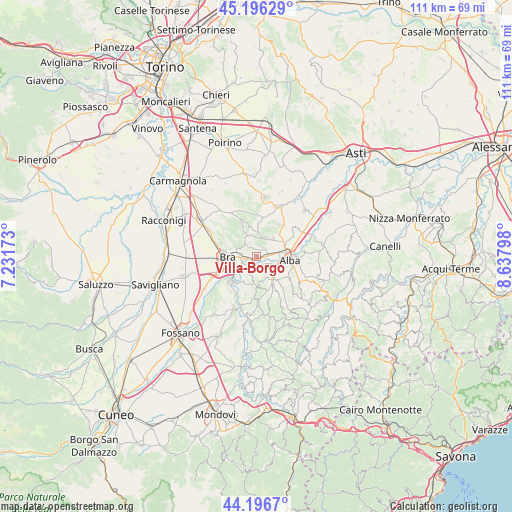
Villa-Borgo GPS coordinates[2]
44° 41' 55.14" North, 7° 56' 5.496" East
| Map corner | latitude | longitude |
|---|---|---|
| Upper-left | 45.19629°, | 7.23173° |
| Center: | 44.69865°, | 7.93486° |
| Lower-right: | 44.1967°, | 8.63798° |
| Map W x H: | 111.1×111.1 km | = 69×69mi |
| max Lat: | 47.04031° ⇑45.8% North |
| Villa-Borgo: | 44.69865° |
| min Lat: | ⇓54.2% South 35.50142° |
| min Long | Villa-Borgo | max Long |
| 6.69888° | 7.93486° | 18.48682° |
| W 5.6%⇐ | ⇒94.4% E |
Elevation
Elevation of Villa-Borgo is 264 m = 866 ft, and this is 42.7 m = 140 ft below average elevation for this country.
| Max E: |
2085 m = 6841 ft | 45.3% |
| Avg. | 306.7 m = 1006 ft | |
| Villa-Borgo | 264 m = 866 ft | |
Min E: |
-4 m = -13 ft | 54.7% |
See also: Italy elevation on elevation.city.
Geographical zone
Villa-Borgo is located in North temperate zone (between Tropic of Cancer and the Arctic Circle). Distance of this Northern Tropic circle is 2364.1 km =1469 mi to South.| Distance of | km | miles | from Villa-Borgo |
|---|---|---|---|
| North Pole | 5037 | 3129.8 | to North |
| Arctic Circle | 2431.2 | 1510.7 | to North |
| Tropic Cancer | 2364.1 | 1469 | to South |
| Equator | 4970 | 3088.2 | to South |


Nearby cities:
15 places around Villa-Borgo: (largest is in red/bold)
• Borgo
2.4 km =1.5 mi,  62°
62°
• Borgo San Martino
3.7 km =2.3 mi,  273°
273°
• Bra
6.6 km =4.1 mi, 269°
• Cinzano
1.3 km =0.8 mi,  240°
240°
• Corneliano d'Alba
4.5 km =2.8 mi,  22°
22°
• Monticello d'Alba
2.3 km =1.4 mi, 15°
• Piobesi d'Alba
5.3 km =3.3 mi,  41°
41°
• Pocapaglia
4.5 km =2.8 mi,  294°
294°
• Pollenzo
3.4 km =2.1 mi,  246°
246°
• Roddi
3.8 km =2.4 mi,  123°
123°
• Santa Vittoria d'Alba
0.2 km =0.1 mi,  90°
90°
• Sommariva Perno
5.9 km =3.7 mi,  332°
332°
• Verduno
3.6 km =2.2 mi,  185°
185°
• Villa
2.3 km =1.4 mi,  12°
12°
• Villa
5.9 km =3.7 mi, 332°
Sources, notices
• [Note1] Compared only with cities in Italy existing in our database
• [Src1] Map data: © OpenStreetMap contributors (CC-BY-SA)
• [Src2] Other city data from geonames.org with taken over terms of usage.
• [Src3] Geographical zone / Annual Mean Temperature by Robert A. Rohde @ Wikipedia
