Al Mughayyir geodata
Al Mughayyir (Karak) is a seat of a third-order administrative division; located in Jordan in Asia/Amman (GMT+3) time zone. In our database, there are 84 cities with bigger population. Compared to other cities in Jordan, 77.5% of cities are located further ↑North; 58% of cities are located further →East and 81.2% of cities have lower elevation than Al Mughayyir. Note1


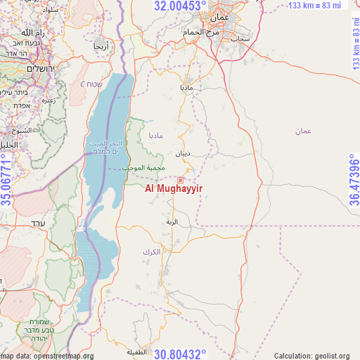
Al Mughayyir GPS coordinates[2]
31° 24' 22.824" North, 35° 46' 14.988" East
| Map corner | latitude | longitude |
|---|---|---|
| Upper-left | 32.00453°, | 35.06771° |
| Center: | 31.40634°, | 35.77083° |
| Lower-right: | 30.80432°, | 36.47396° |
| Map W x H: | 133.5×133.5 km | = 83×83mi |
| max Lat: | 33.31405° ⇑77.5% North |
| Al Mughayyir: | 31.40634° |
| min Lat: | ⇓22.5% South 29.40842° |
| min Long | Al Mughayyir | max Long |
| 34.97918° | 35.77083° | 38.70342° |
| W 42%⇐ | ⇒58% E |
Elevation
Elevation of Al Mughayyir is 932 m = 3058 ft, and this is 246.3 m = 808 ft above average elevation for this country.
| Max E: |
1440 m = 4724 ft | 18.8% |
| Al Mughayyir | 932 m 3058 ft | |
| Avg. | 685.7 m = 2250 ft | |
Min E: |
-366 m = -1201 ft | 81.2% |
See also: Jordan elevation on elevation.city.
Geographical zone
Al Mughayyir is located in North temperate zone (between Tropic of Cancer and the Arctic Circle). Distance of this Northern Tropic circle is 886.1 km =550.6 mi to South.| Distance of | km | miles | from Al Mughayyir |
|---|---|---|---|
| North Pole | 6515 | 4048.2 | to North |
| Arctic Circle | 3909.1 | 2429 | to North |
| Tropic Cancer | 886.1 | 550.6 | to South |
| Equator | 3492.1 | 2169.9 | to South |


Nearby cities:
15 places around Al Mughayyir: (largest is in red/bold)
• Adir
22.7 km =14.1 mi,  182°
182°
• Al Qaşr
10.6 km =6.6 mi,  193°
193°
• Al Qaţrānah
31.6 km =19.6 mi,  123°
123°
• Al ‘Arīḑ
20 km =12.4 mi,  327°
327°
• Ar Rabbah
15.6 km =9.7 mi, 191°
• Dhībān
10.4 km =6.5 mi,  6°
6°
• Fuqū‘
7.8 km =4.8 mi,  236°
236°
• Ghawr al Mazra‘ah
28.7 km =17.8 mi, 237°
• Karak City
27 km =16.8 mi, 181°
• Mulayḩ
20.2 km =12.6 mi, 9°
• Mā‘īn
30.7 km =19.1 mi,  353°
353°
• Qīr Moāv
25.8 km =16 mi,  195°
195°
• Umm ar Raşāş
18.3 km =11.4 mi,  49°
49°
• ‘Ayy
32.6 km =20.3 mi, 201°
• ‘Izrā
28.5 km =17.7 mi, 195°
Sources, notices
• [Note1] Compared only with cities in Jordan existing in our database
• [Src1] Map data: © OpenStreetMap contributors (CC-BY-SA)
• [Src2] Other city data from geonames.org with taken over terms of usage.
• [Src3] Geographical zone / Annual Mean Temperature by Robert A. Rohde @ Wikipedia
