‘Izrā geodata
‘Izrā (Karak) is a populated place; located in Jordan in Asia/Amman (GMT+3) time zone. With population of 22,756 people, there are 18 cities with bigger population in this country. Compared to other cities in Jordan, 84.1% of cities are located further ↑North; 78.3% of cities are located further →East and 92.8% of cities have lower elevation than ‘Izrā. Note1


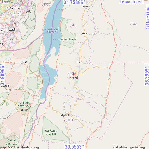
‘Izrā GPS coordinates[2]
31° 9' 32.004" North, 35° 41' 34.008" East
| Map corner | latitude | longitude |
|---|---|---|
| Upper-left | 31.75866°, | 34.98966° |
| Center: | 31.15889°, | 35.69278° |
| Lower-right: | 30.5553°, | 36.39591° |
| Map W x H: | 133.8×133.8 km | = 83.1×83.1mi |
| max Lat: | 33.31405° ⇑84.1% North |
| ‘Izrā: | 31.15889° |
| min Lat: | ⇓15.9% South 29.40842° |
| min Long | ‘Izrā | max Long |
| 34.97918° | 35.69278° | 38.70342° |
| W 21.7%⇐ | ⇒78.3% E |
Elevation
Elevation of ‘Izrā is 1111 m = 3645 ft, and this is 425.3 m = 1395 ft above average elevation for this country.
| Max E: |
1440 m = 4724 ft | 7.2% |
| ‘Izrā | 1111 m 3645 ft | |
| Avg. | 685.7 m = 2250 ft | |
Min E: |
-366 m = -1201 ft | 92.8% |
See also: Jordan elevation on elevation.city.
Geographical zone
‘Izrā is located in North temperate zone (between Tropic of Cancer and the Arctic Circle). Distance of this Northern Tropic circle is 858.6 km =533.5 mi to South.| Distance of | km | miles | from ‘Izrā |
|---|---|---|---|
| North Pole | 6542.5 | 4065.3 | to North |
| Arctic Circle | 3936.6 | 2446.1 | to North |
| Tropic Cancer | 858.6 | 533.5 | to South |
| Equator | 3464.5 | 2152.7 | to South |


Nearby cities:
15 places around ‘Izrā: (largest is in red/bold)
• Adir
8.1 km =5 mi,  53°
53°
• Al Khinzīrah
14.6 km =9.1 mi,  214°
214°
• Al Mazār al Janūbī
10.2 km =6.3 mi,  178°
178°
• Al Mughayyir
28.5 km =17.7 mi,  15°
15°
• Al Qaşr
17.9 km =11.1 mi, 15°
• Al Qaţrānah
35.4 km =22 mi,  73°
73°
• Al Ḩusaynīyah
15 km =9.3 mi,  168°
168°
• Ar Rabbah
13 km =8.1 mi, 19°
• Aţ Ţafīlah
36.7 km =22.8 mi,  193°
193°
• Fuqū‘
23.3 km =14.5 mi,  2°
2°
• Ghawr al Mazra‘ah
20.5 km =12.7 mi,  305°
305°
• Karak City
6.6 km =4.1 mi,  85°
85°
• Qīr Moāv
2.7 km =1.7 mi,  14°
14°
• Safi
25.6 km =15.9 mi,  237°
237°
• ‘Ayy
5.4 km =3.4 mi, 239°
Sources, notices
• [Note1] Compared only with cities in Jordan existing in our database
• [Src1] Map data: © OpenStreetMap contributors (CC-BY-SA)
• [Src2] Other city data from geonames.org with taken over terms of usage.
• [Src3] Geographical zone / Annual Mean Temperature by Robert A. Rohde @ Wikipedia
