Yokkaichi geodata
Yokkaichi (Mie) is a seat of a second-order administrative division; located in Japan in Asia/Tokyo (GMT+9) time zone. With population of 295,841 people, there are 68 cities with bigger population in this country. Compared to other cities in Japan, 60% of cities are located further ↑North; 57.2% of cities are located further →East and 79% of cities have higher elevation than Yokkaichi. Note1


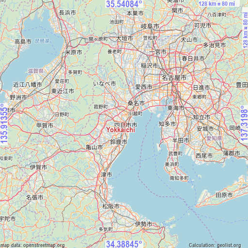
Yokkaichi GPS coordinates[2]
34° 58' 0.012" North, 136° 37' 0.012" East
| Map corner | latitude | longitude |
|---|---|---|
| Upper-left | 35.54084°, | 135.91355° |
| Center: | 34.96667°, | 136.61667° |
| Lower-right: | 34.38845°, | 137.3198° |
| Map W x H: | 128.1×128.1 km | = 79.6×79.6mi |
| max Lat: | 45.40944° ⇑60% North |
| Yokkaichi: | 34.96667° |
| min Lat: | ⇓40% South 24.34478° |
| min Long | Yokkaichi | max Long |
| 123° | 136.61667° | 145.575° |
| W 42.8%⇐ | ⇒57.2% E |
Elevation
Elevation of Yokkaichi is 8 m = 26 ft, and this is 76.6 m = 251 ft below average elevation for this country.
| Max E: |
1086 m = 3563 ft | 79% |
| Avg. | 84.6 m = 278 ft | |
| Yokkaichi | 8 m = 26 ft | |
Min E: |
-2 m = -7 ft | 21% |
See also: Yokkaichi elevation on elevation.city.
Geographical zone
Yokkaichi is located in North temperate zone (between Tropic of Cancer and the Arctic Circle). Distance of this Northern Tropic circle is 1282 km =796.6 mi to South.| Distance of | km | miles | from Yokkaichi |
|---|---|---|---|
| North Pole | 6119.1 | 3802.2 | to North |
| Arctic Circle | 3513.2 | 2183 | to North |
| Tropic Cancer | 1282 | 796.6 | to South |
| Equator | 3887.9 | 2415.8 | to South |


Nearby cities:
15 places around Yokkaichi: (largest is in red/bold)
• Aisai
24.3 km =15.1 mi,  25°
25°
• Chita
22.9 km =14.2 mi,  79°
79°
• Inabe
16.8 km =10.4 mi,  346°
346°
• Kaizu
26.2 km =16.3 mi,  3°
3°
• Kameyama
20 km =12.4 mi,  229°
229°
• Kanie
24.9 km =15.5 mi,  42°
42°
• Kasado
11.5 km =7.1 mi,  223°
223°
• Kawage
19.1 km =11.9 mi,  199°
199°
• Komono
9.8 km =6.1 mi,  292°
292°
• Kuwana
10.6 km =6.6 mi, 26°
• Suzuka
9.8 km =6.1 mi, 198°
• Tokoname
23.2 km =14.4 mi,  113°
113°
• Tsushima
24 km =14.9 mi,  22°
22°
• Tōkai
27.3 km =17 mi, 76°
• Yatomi
18.7 km =11.6 mi, 34°
Sources, notices
• [Note1] Compared only with cities in Japan existing in our database
• [Src1] Map data: © OpenStreetMap contributors (CC-BY-SA)
• [Src2] Other city data from geonames.org with taken over terms of usage.
• [Src3] Geographical zone / Annual Mean Temperature by Robert A. Rohde @ Wikipedia
