Kuwana geodata
Kuwana (Mie) is a seat of a second-order administrative division; located in Japan in Asia/Tokyo (GMT+9) time zone. With population of 140,051 people, there are 147 cities with bigger population in this country. Compared to other cities in Japan, 57.2% of cities are located further ↑North; 56.5% of cities are located further →East and 79% of cities have higher elevation than Kuwana. Note1


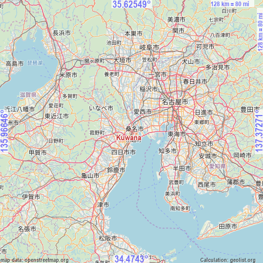
Kuwana GPS coordinates[2]
35° 3' 6.912" North, 136° 40' 10.488" East
| Map corner | latitude | longitude |
|---|---|---|
| Upper-left | 35.62549°, | 135.96646° |
| Center: | 35.05192°, | 136.66958° |
| Lower-right: | 34.4743°, | 137.37271° |
| Map W x H: | 128×128 km | = 79.5×79.5mi |
| max Lat: | 45.40944° ⇑57.2% North |
| Kuwana: | 35.05192° |
| min Lat: | ⇓42.8% South 24.34478° |
| min Long | Kuwana | max Long |
| 123° | 136.66958° | 145.575° |
| W 43.5%⇐ | ⇒56.5% E |
Elevation
Elevation of Kuwana is 8 m = 26 ft, and this is 76.6 m = 251 ft below average elevation for this country.
| Max E: |
1086 m = 3563 ft | 79% |
| Avg. | 84.6 m = 278 ft | |
| Kuwana | 8 m = 26 ft | |
Min E: |
-2 m = -7 ft | 21% |
See also: Kuwana elevation on elevation.city.
Geographical zone
Kuwana is located in North temperate zone (between Tropic of Cancer and the Arctic Circle). Distance of this Northern Tropic circle is 1291.5 km =802.5 mi to South.| Distance of | km | miles | from Kuwana |
|---|---|---|---|
| North Pole | 6109.7 | 3796.4 | to North |
| Arctic Circle | 3503.8 | 2177.2 | to North |
| Tropic Cancer | 1291.5 | 802.5 | to South |
| Equator | 3897.4 | 2421.7 | to South |


Nearby cities:
15 places around Kuwana: (largest is in red/bold)
• Aisai
13.7 km =8.5 mi,  24°
24°
• Ama
18.8 km =11.7 mi,  39°
39°
• Chita
18.5 km =11.5 mi,  107°
107°
• Inabe
11.2 km =7 mi,  307°
307°
• Kaizu
16.9 km =10.5 mi,  349°
349°
• Kanie
14.9 km =9.3 mi,  52°
52°
• Kasado
21.9 km =13.6 mi,  215°
215°
• Kiyosu
23.6 km =14.7 mi, 39°
• Komono
15.1 km =9.4 mi,  247°
247°
• Sobue
22.4 km =13.9 mi,  10°
10°
• Suzuka
20.3 km =12.6 mi,  202°
202°
• Tsushima
13.5 km =8.4 mi, 18°
• Tōkai
22 km =13.7 mi,  98°
98°
• Yatomi
8.3 km =5.2 mi, 44°
• Yokkaichi
10.6 km =6.6 mi,  206°
206°
Sources, notices
• [Note1] Compared only with cities in Japan existing in our database
• [Src1] Map data: © OpenStreetMap contributors (CC-BY-SA)
• [Src2] Other city data from geonames.org with taken over terms of usage.
• [Src3] Geographical zone / Annual Mean Temperature by Robert A. Rohde @ Wikipedia
