Teaoraereke Village geodata
Teaoraereke Village (Gilbert Islands) is a populated place; located in Kiribati in Pacific/Tarawa (GMT+12) time zone. With population of 3,939 people, there are 3 cities with bigger population in this country. Compared to other cities in Kiribati, 60% of cities are located further ↑North; 62.9% of cities are located further →East and 94.3% of cities have lower elevation than Teaoraereke Village. Note1


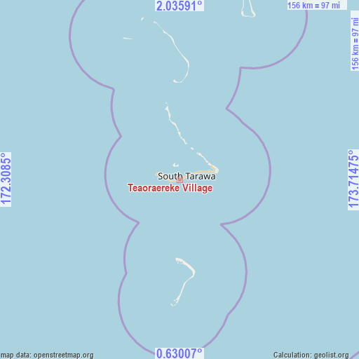
Teaoraereke Village GPS coordinates[2]
1° 19' 59.124" North, 173° 0' 41.832" East
| Map corner | latitude | longitude |
|---|---|---|
| Upper-left | 2.03591°, | 172.3085° |
| Center: | 1.33309°, | 173.01162° |
| Lower-right: | 0.63007°, | 173.71475° |
| Map W x H: | 156.3×156.3 km | = 97.1×97.1mi |
| max Lat: | 3.90806° ⇑60% North |
| Teaoraereke Village: | 1.33309° |
| min Lat: | ⇓40% South -2.65512° |
| min Long | Teaoraereke Vil | max Long |
| -159.38832° | 173.01162° | 176.83302° |
| W 37.1%⇐ | ⇒62.9% E |
Elevation
Elevation of Teaoraereke Village is 13 m = 43 ft, and this is 3.1 m = 10 ft above average elevation for this country.
| Max E: |
13 m = 43 ft | 5.7% |
| Teaoraereke Village | 13 m 43 ft | |
| Avg. | 9.9 m = 32 ft | |
Min E: |
6 m = 20 ft | 94.3% |
See also: Kiribati elevation on elevation.city.
Geographical zone
Teaoraereke Village is located in North Torrid zone (between Equator and Tropic of Cancer). Distance of Equator is 148.2 km =92.1 mi to South.| Distance of | km | miles | from Teaoraereke Village |
|---|---|---|---|
| North Pole | 9858.8 | 6126 | to North |
| Arctic Circle | 7252.9 | 4506.7 | to North |
| Tropic Cancer | 2457.7 | 1527.1 | to North |
| Equator | 148.2 | 92.1 | to South |


Nearby cities:
15 places around Teaoraereke Village: (largest is in red/bold)
• Abarao Village
11.4 km =7.1 mi,  73°
73°
• Ambo Village
4.1 km =2.5 mi,  57°
57°
• Bairiki Village
4.1 km =2.5 mi,  263°
263°
• Banraeaba Village
2.9 km =1.8 mi, 61°
• Betio Village
10.4 km =6.5 mi,  285°
285°
• Bikenibeu Village
13.1 km =8.1 mi, 73°
• Bonriki Village
15.1 km =9.4 mi, 69°
• Buota Village
14.7 km =9.1 mi, 64°
• Eita Village
8.3 km =5.2 mi, 67°
• Nanikai Village
1.6 km =1 mi, 257°
• Nawerewere Village
14.6 km =9.1 mi,  76°
76°
• Taborio Village
5.4 km =3.4 mi, 61°
• Taborio Village
20.8 km =12.9 mi,  357°
357°
• Tarawa
3.9 km =2.4 mi, 261°
• Temaiku Village
17.1 km =10.6 mi, 78°
Sources, notices
• [Note1] Compared only with cities in Kiribati existing in our database
• [Src1] Map data: © OpenStreetMap contributors (CC-BY-SA)
• [Src2] Other city data from geonames.org with taken over terms of usage.
• [Src3] Geographical zone / Annual Mean Temperature by Robert A. Rohde @ Wikipedia
