Limbi geodata
Limbi (Anjouan) is a populated place; located in Comoros in Indian/Comoro (GMT+3) time zone. With population of 1,037 people, there are 86 cities with bigger population in this country. Compared to other cities in Comoros, 77.9% of cities are located further ↑North; 94.7% of cities are located further ←West and 83.2% of cities have lower elevation than Limbi. Note1


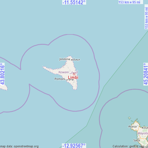
Limbi GPS coordinates[2]
12° 14' 21.984" South, 44° 30' 19.008" East
| Map corner | latitude | longitude |
|---|---|---|
| Upper-left | -11.55142°, | 43.80216° |
| Center: | -12.23944°, | 44.50528° |
| Lower-right: | -12.92567°, | 45.20841° |
| Map W x H: | 152.8×152.8 km | = 94.9×94.9mi |
| max Lat: | -11.38472° ⇑77.9% North |
| Limbi: | -12.23944° |
| min Lat: | ⇓22.1% South -12.37306° |
| min Long | Limbi | max Long |
| 43.2525° | 44.50528° | 44.53194° |
| W 94.7%⇐ | ⇒5.3% E |
Elevation
Elevation of Limbi is 380 m = 1247 ft, and this is 183.9 m = 603 ft above average elevation for this country.
| Max E: |
924 m = 3031 ft | 16.8% |
| Limbi | 380 m 1247 ft | |
| Avg. | 196.1 m = 643 ft | |
Min E: |
1 m = 3 ft | 83.2% |
See also: Comoros elevation on elevation.city.
Geographical zone
Limbi is located in South Torrid zone (between Equator and Tropic of Capricorn). Distance of this Southern Tropic circle is 1245 km =773.6 mi to South.| Distance of | km | miles | from Limbi |
|---|---|---|---|
| Equator | 1360.9 | 845.6 | to North |
| Tropic Capricorn | 1245 | 773.6 | to South |
| Antarctic Circle | 6040.3 | 3753.3 | to South |
| South Pole | 8646.2 | 5372.5 | to South |


Nearby cities:
15 places around Limbi: (largest is in red/bold)
• Adda-Douéni
6 km =3.7 mi,  188°
188°
• Bambao
4.2 km =2.6 mi,  16°
16°
• Chandra
6.6 km =4.1 mi,  318°
318°
• Daji
9.8 km =6.1 mi, 190°
• Domoni
3.5 km =2.2 mi,  123°
123°
• Dziani
6.7 km =4.2 mi,  339°
339°
• Harembo
9.9 km =6.2 mi,  355°
355°
• Kangani
9.7 km =6 mi,  201°
201°
• Koni-Djodjo
2.8 km =1.7 mi,  292°
292°
• Koni-Ngani
3.8 km =2.4 mi,  313°
313°
• Lingoni
9.6 km =6 mi,  259°
259°
• Mrémani
7.7 km =4.8 mi, 185°
• Ongoni
7.7 km =4.8 mi,  1°
1°
• Ouzini
4.2 km =2.6 mi,  221°
221°
• Tsimbeo
5.8 km =3.6 mi, 310°
Sources, notices
• [Note1] Compared only with cities in Comoros existing in our database
• [Src1] Map data: © OpenStreetMap contributors (CC-BY-SA)
• [Src2] Other city data from geonames.org with taken over terms of usage.
• [Src3] Geographical zone / Annual Mean Temperature by Robert A. Rohde @ Wikipedia
