Seogeom-ri geodata
Seogeom-ri (Incheon) is a seat of a fourth-order administrative division; located in South Korea in Asia/Seoul (GMT+9) time zone. In our database, there are 128 cities with bigger population. Compared to other cities in South Korea, 87.4% of cities are located further ↓South; 98.3% of cities are located further →East and 75.5% of cities have higher elevation than Seogeom-ri. Note1


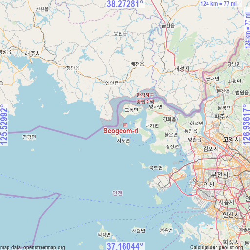
Seogeom-ri GPS coordinates[2]
37° 43' 7.356" North, 126° 13' 58.944" East
| Map corner | latitude | longitude |
|---|---|---|
| Upper-left | 38.27281°, | 125.52992° |
| Center: | 37.71871°, | 126.23304° |
| Lower-right: | 37.16044°, | 126.93617° |
| Map W x H: | 123.7×123.7 km | = 76.9×76.9mi |
| max Lat: | 38.37881° ⇑12.6% North |
| Seogeom-ri: | 37.71871° |
| min Lat: | ⇓87.4% South 33.25333° |
| min Long | Seogeom-ri | max Long |
| 126.10863° | 126.23304° | 129.55377° |
| W 1.7%⇐ | ⇒98.3% E |
Elevation
Elevation of Seogeom-ri is 18 m = 59 ft, and this is 52.4 m = 172 ft below average elevation for this country.
| Max E: |
691 m = 2267 ft | 75.5% |
| Avg. | 70.4 m = 231 ft | |
| Seogeom-ri | 18 m = 59 ft | |
Min E: |
1 m = 3 ft | 24.5% |
See also: South Korea elevation on elevation.city.
Geographical zone
Seogeom-ri is located in North temperate zone (between Tropic of Cancer and the Arctic Circle). Distance of this Northern Tropic circle is 1588 km =986.7 mi to South.| Distance of | km | miles | from Seogeom-ri |
|---|---|---|---|
| North Pole | 5813.1 | 3612.1 | to North |
| Arctic Circle | 3207.2 | 1992.9 | to North |
| Tropic Cancer | 1588 | 986.7 | to South |
| Equator | 4193.9 | 2606 | to South |


Nearby cities:
15 places around Seogeom-ri: (largest is in red/bold)
• Bupyeong
49.2 km =30.6 mi,  118°
118°
• Ganghwa-gun
22.4 km =13.9 mi,  81°
81°
• Gyodong
8.3 km =5.2 mi,  30°
30°
• Hajeom
16.9 km =10.5 mi,  68°
68°
• Haseong
35 km =21.7 mi,  89°
89°
• Incheon
50.8 km =31.6 mi,  125°
125°
• Munsan
51 km =31.7 mi, 72°
• Paju
52.9 km =32.9 mi, 76°
• Samsan
8 km =5 mi,  102°
102°
• Seonwon
22.1 km =13.7 mi, 91°
• Songhae
21.1 km =13.1 mi, 76°
• Tanhyeon
43.5 km =27 mi, 77°
• Tongjin
32.3 km =20.1 mi, 95°
• Wolgot
28.3 km =17.6 mi, 90°
• Yangsa
17.8 km =11.1 mi,  59°
59°
Sources, notices
• [Note1] Compared only with cities in South Korea existing in our database
• [Src1] Map data: © OpenStreetMap contributors (CC-BY-SA)
• [Src2] Other city data from geonames.org with taken over terms of usage.
• [Src3] Geographical zone / Annual Mean Temperature by Robert A. Rohde @ Wikipedia
