Kinzan geodata
Kinzan (Chungcheongnam-do) is a populated place; located in South Korea in Asia/Seoul (GMT+9) time zone. With population of 25,243 people, there are 111 cities with bigger population in this country. Compared to other cities in South Korea, 51.7% of cities are located further ↓South; 59.4% of cities are located further ←West and 89.2% of cities have lower elevation than Kinzan. Note1


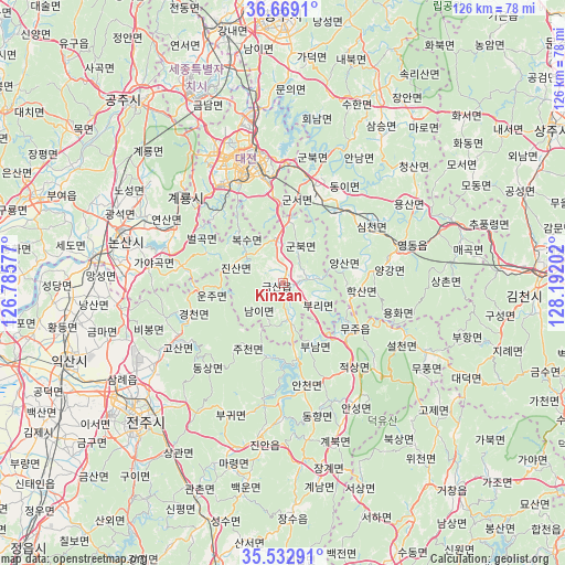
Kinzan GPS coordinates[2]
36° 6' 11.016" North, 127° 29' 20.004" East
| Map corner | latitude | longitude |
|---|---|---|
| Upper-left | 36.6691°, | 126.78577° |
| Center: | 36.10306°, | 127.48889° |
| Lower-right: | 35.53291°, | 128.19202° |
| Map W x H: | 126.3×126.3 km | = 78.5×78.5mi |
| max Lat: | 38.37881° ⇑48.3% North |
| Kinzan: | 36.10306° |
| min Lat: | ⇓51.7% South 33.25333° |
| min Long | Kinzan | max Long |
| 126.10863° | 127.48889° | 129.55377° |
| W 59.4%⇐ | ⇒40.6% E |
Elevation
Elevation of Kinzan is 160 m = 525 ft, and this is 89.6 m = 294 ft above average elevation for this country.
| Max E: |
691 m = 2267 ft | 10.8% |
| Kinzan | 160 m 525 ft | |
| Avg. | 70.4 m = 231 ft | |
Min E: |
1 m = 3 ft | 89.2% |
See also: South Korea elevation on elevation.city.
Geographical zone
Kinzan is located in North temperate zone (between Tropic of Cancer and the Arctic Circle). Distance of this Northern Tropic circle is 1408.4 km =875.1 mi to South.| Distance of | km | miles | from Kinzan |
|---|---|---|---|
| North Pole | 5992.8 | 3723.8 | to North |
| Arctic Circle | 3386.9 | 2104.5 | to North |
| Tropic Cancer | 1408.4 | 875.1 | to South |
| Equator | 4014.3 | 2494.4 | to South |


Nearby cities:
15 places around Kinzan: (largest is in red/bold)
• Annam
32.7 km =20.3 mi,  30°
30°
• Cheongseong
34.8 km =21.6 mi,  44°
44°
• Daejeon
28.9 km =18 mi,  341°
341°
• Dongi
23.3 km =14.5 mi, 30°
• Gunbuk
8 km =5 mi, 25°
• Gunbuk
25.6 km =15.9 mi,  9°
9°
• Gunseo
19.8 km =12.3 mi, 9°
• Iwon
19.8 km =12.3 mi, 36°
• Jinan-gun
35.1 km =21.8 mi,  189°
189°
• Jinjam
26.8 km =16.7 mi,  324°
324°
• Okcheon
23.1 km =14.4 mi,  17°
17°
• Simcheon
25.7 km =16 mi,  54°
54°
• Yeongdong
27 km =16.8 mi,  72°
72°
• Yongsan
35.1 km =21.8 mi,  60°
60°
• Yuseong
31.1 km =19.3 mi,  333°
333°
Sources, notices
• [Note1] Compared only with cities in South Korea existing in our database
• [Src1] Map data: © OpenStreetMap contributors (CC-BY-SA)
• [Src2] Other city data from geonames.org with taken over terms of usage.
• [Src3] Geographical zone / Annual Mean Temperature by Robert A. Rohde @ Wikipedia
