Yuchi geodata
Yuchi (Jeollanam-do) is a seat of a third-order administrative division; located in South Korea in Asia/Seoul (GMT+9) time zone. In our database, there are 128 cities with bigger population. Compared to other cities in South Korea, 94.1% of cities are located further ↑North; 74.8% of cities are located further →East and 73.8% of cities have lower elevation than Yuchi. Note1


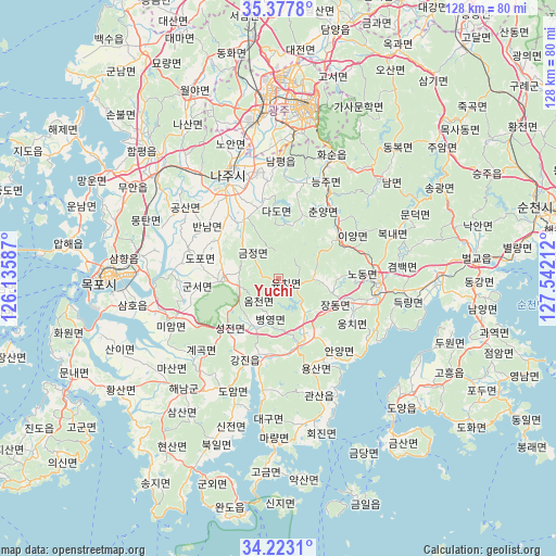
Yuchi GPS coordinates[2]
34° 48' 8.892" North, 126° 50' 20.364" East
| Map corner | latitude | longitude |
|---|---|---|
| Upper-left | 35.3778°, | 126.13587° |
| Center: | 34.80247°, | 126.83899° |
| Lower-right: | 34.2231°, | 127.54212° |
| Map W x H: | 128.4×128.4 km | = 79.8×79.8mi |
| max Lat: | 38.37881° ⇑94.1% North |
| Yuchi: | 34.80247° |
| min Lat: | ⇓5.9% South 33.25333° |
| min Long | Yuchi | max Long |
| 126.10863° | 126.83899° | 129.55377° |
| W 25.2%⇐ | ⇒74.8% E |
Elevation
Elevation of Yuchi is 91 m = 299 ft, and this is 20.6 m = 68 ft above average elevation for this country.
| Max E: |
691 m = 2267 ft | 26.2% |
| Yuchi | 91 m 299 ft | |
| Avg. | 70.4 m = 231 ft | |
Min E: |
1 m = 3 ft | 73.8% |
See also: South Korea elevation on elevation.city.
Geographical zone
Yuchi is located in North temperate zone (between Tropic of Cancer and the Arctic Circle). Distance of this Northern Tropic circle is 1263.8 km =785.3 mi to South.| Distance of | km | miles | from Yuchi |
|---|---|---|---|
| North Pole | 6137.4 | 3813.6 | to North |
| Arctic Circle | 3531.5 | 2194.4 | to North |
| Tropic Cancer | 1263.8 | 785.3 | to South |
| Equator | 3869.7 | 2404.5 | to South |


Nearby cities:
15 places around Yuchi: (largest is in red/bold)
• Bannam
20.5 km =12.7 mi,  303°
303°
• Boseong
22.3 km =13.9 mi,  98°
98°
• Cheongpung
14.6 km =9.1 mi,  55°
55°
• Deokjin
13.1 km =8.1 mi,  278°
278°
• Dopo
18.5 km =11.5 mi,  285°
285°
• Geumjeong
10.7 km =6.6 mi,  309°
309°
• Hancheolli
24.1 km =15 mi,  37°
37°
• Iyang
16.7 km =10.4 mi,  54°
54°
• Jangheung
14.8 km =9.2 mi,  155°
155°
• Miryeok
22.7 km =14.1 mi,  90°
90°
• Naju
27.5 km =17.1 mi,  336°
336°
• Nodong
21.2 km =13.2 mi, 91°
• Seji
15.4 km =9.6 mi,  327°
327°
• Sijong
22.4 km =13.9 mi, 289°
• Yeongam
13 km =8.1 mi,  269°
269°
Sources, notices
• [Note1] Compared only with cities in South Korea existing in our database
• [Src1] Map data: © OpenStreetMap contributors (CC-BY-SA)
• [Src2] Other city data from geonames.org with taken over terms of usage.
• [Src3] Geographical zone / Annual Mean Temperature by Robert A. Rohde @ Wikipedia
