Bayān geodata
Bayān (Hawalli) is a section of populated place; located in Kuwait in Asia/Kuwait (GMT+3) time zone. With population of 30,635 people, there are 12 cities with bigger population in this country. Compared to other cities in Kuwait, 68% of cities are located further ↓South; 64% of cities are located further →East and 64% of cities have lower elevation than Bayān. Note1


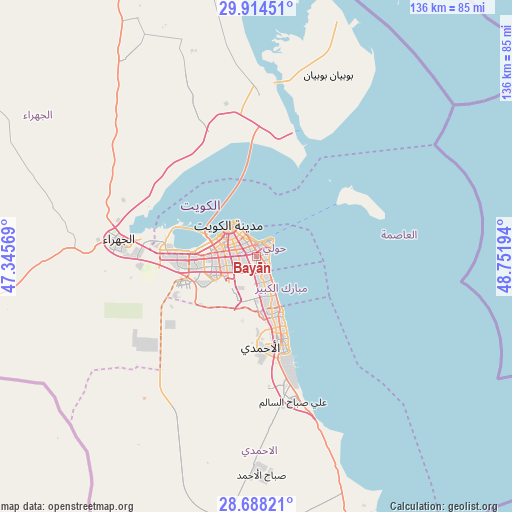
Bayān GPS coordinates[2]
29° 18' 11.52" North, 48° 2' 55.716" East
| Map corner | latitude | longitude |
|---|---|---|
| Upper-left | 29.91451°, | 47.34569° |
| Center: | 29.3032°, | 48.04881° |
| Lower-right: | 28.68821°, | 48.75194° |
| Map W x H: | 136.4×136.4 km | = 84.8×84.8mi |
| max Lat: | 29.4425° ⇑32% North |
| Bayān: | 29.3032° |
| min Lat: | ⇓68% South 28.63917° |
| min Long | Bayān | max Long |
| 47.65806° | 48.04881° | 48.27472° |
| W 36%⇐ | ⇒64% E |
Elevation
Elevation of Bayān is 20 m = 66 ft, and this is 6.7 m = 22 ft below average elevation for this country.
| Max E: |
164 m = 538 ft | 36% |
| Avg. | 26.7 m = 88 ft | |
| Bayān | 20 m = 66 ft | |
Min E: |
4 m = 13 ft | 64% |
See also: Kuwait elevation on elevation.city.
Geographical zone
Bayān is located in North temperate zone (between Tropic of Cancer and the Arctic Circle). Distance of this Northern Tropic circle is 652.3 km =405.3 mi to South.| Distance of | km | miles | from Bayān |
|---|---|---|---|
| North Pole | 6748.9 | 4193.6 | to North |
| Arctic Circle | 4143 | 2574.3 | to North |
| Tropic Cancer | 652.3 | 405.3 | to South |
| Equator | 3258.2 | 2024.6 | to South |


Nearby cities:
15 places around Bayān: (largest is in red/bold)
• Abu Fatira
12.9 km =8 mi,  155°
155°
• Ad Dasmah
8.3 km =5.2 mi,  326°
326°
• Al Farwānīyah
9.2 km =5.7 mi,  251°
251°
• Al Funayţīs
10.1 km =6.3 mi,  149°
149°
• Al-Masayel
8.1 km =5 mi, 151°
• Ar Rumaythīyah
2.6 km =1.6 mi,  69°
69°
• Ar Rābiyah
11.3 km =7 mi,  265°
265°
• As Sālimīyah
4.3 km =2.7 mi,  37°
37°
• Ash Shāmīyah
9.8 km =6.1 mi,  300°
300°
• Janūb as Surrah
7.8 km =4.8 mi,  241°
241°
• Kuwait City
10.1 km =6.3 mi,  317°
317°
• Mubārak al Kabīr
13.1 km =8.1 mi, 163°
• Salwá
3 km =1.9 mi,  105°
105°
• Şabāḩ as Sālim
5.2 km =3.2 mi,  170°
170°
• Ḩawallī
3.8 km =2.4 mi, 329°
Sources, notices
• [Note1] Compared only with cities in Kuwait existing in our database
• [Src1] Map data: © OpenStreetMap contributors (CC-BY-SA)
• [Src2] Other city data from geonames.org with taken over terms of usage.
• [Src3] Geographical zone / Annual Mean Temperature by Robert A. Rohde @ Wikipedia
