Triesenberg geodata
Triesenberg is a seat of a first-order administrative division; located in Liechtenstein in Europe/Vaduz (GMT+2) time zone. With population of 2,689 people, there are 6 cities with bigger population in this country. Compared to other cities in Liechtenstein, 80% of cities are located further ↑North; 70% of cities are located further ←West and 100% of cities have lower elevation than Triesenberg. Note1


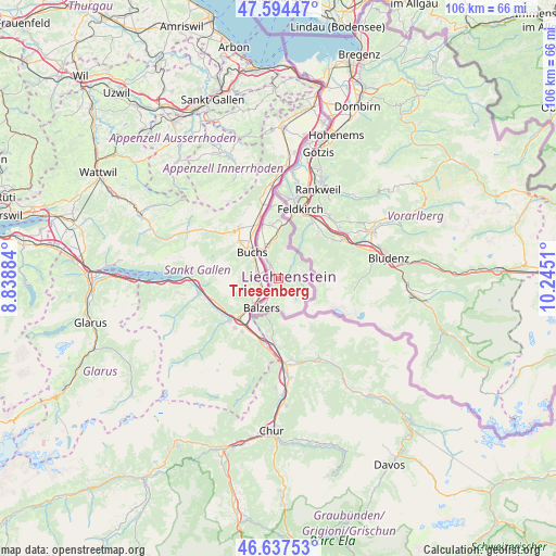
Triesenberg GPS coordinates[2]
47° 7' 5.34" North, 9° 32' 31.092" East
| Map corner | latitude | longitude |
|---|---|---|
| Upper-left | 47.59447°, | 8.83884° |
| Center: | 47.11815°, | 9.54197° |
| Lower-right: | 46.63753°, | 10.2451° |
| Map W x H: | 106.4×106.4 km | = 66.1×66.1mi |
| max Lat: | 47.23799° ⇑80% North |
| Triesenberg: | 47.11815° |
| min Lat: | ⇓20% South 47.06665° |
| min Long | Triesenberg | max Long |
| 9.50251° | 9.54197° | 9.54678° |
| W 70%⇐ | ⇒30% E |
Elevation
Elevation of Triesenberg is 854 m = 2802 ft, and this is 311.6 m = 1022 ft above average elevation for this country.
| Max E: |
854 m = 2802 ft | 0% |
| Triesenberg | 854 m 2802 ft | |
| Avg. | 542.4 m = 1780 ft | |
Min E: |
434 m = 1424 ft | 100% |
See also: Liechtenstein elevation on elevation.city.
Geographical zone
Triesenberg is located in North temperate zone (between Tropic of Cancer and the Arctic Circle). Distance of this North polar circle is 2162.1 km =1343.5 mi to North.| Distance of | km | miles | from Triesenberg |
|---|---|---|---|
| North Pole | 4768 | 2962.7 | to North |
| Arctic Circle | 2162.1 | 1343.5 | to North |
| Tropic Cancer | 2633.1 | 1636.1 | to South |
| Equator | 5239 | 3255.4 | to South |


Nearby cities:
10 places around Triesenberg: (largest is in red/bold)
• Balzers
6.5 km =4 mi,  207°
207°
• Eschen
10.4 km =6.5 mi,  351°
351°
• Gamprin
11.6 km =7.2 mi, 347°
• Mauren
11.1 km =6.9 mi,  0°
0°
• Planken
7.5 km =4.7 mi, 1°
• Ruggell
13.4 km =8.3 mi, 354°
• Schaan
5.8 km =3.6 mi,  334°
334°
• Schellenberg
12.6 km =7.8 mi, 1°
• Triesen
1.6 km =1 mi,  221°
221°
• Vaduz
3 km =1.9 mi, 329°
Sources, notices
• [Note1] Compared only with cities in Liechtenstein existing in our database
• [Src1] Map data: © OpenStreetMap contributors (CC-BY-SA)
• [Src2] Other city data from geonames.org with taken over terms of usage.
• [Src3] Geographical zone / Annual Mean Temperature by Robert A. Rohde @ Wikipedia
