Elektrėnai geodata
Elektrėnai (Vilnius) is a populated place; located in Lithuania in Europe/Vilnius (GMT+3) time zone. With population of 13,721 people, there are 38 cities with bigger population in this country. Compared to other cities in Lithuania, 70.1% of cities are located further ↑North; 67.9% of cities are located further ←West and 67.9% of cities have lower elevation than Elektrėnai. Note1


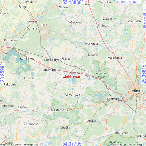
Elektrėnai GPS coordinates[2]
54° 47' 7.584" North, 24° 39' 46.872" East
| Map corner | latitude | longitude |
|---|---|---|
| Upper-left | 55.18886°, | 23.9599° |
| Center: | 54.78544°, | 24.66302° |
| Lower-right: | 54.37795°, | 25.36615° |
| Map W x H: | 90.2×90.2 km | = 56×56mi |
| max Lat: | 56.36149° ⇑70.1% North |
| Elektrėnai: | 54.78544° |
| min Lat: | ⇓29.9% South 54.01573° |
| min Long | Elektrėnai | max Long |
| 20.99651° | 24.66302° | 26.43984° |
| W 67.9%⇐ | ⇒32.1% E |
Elevation
Elevation of Elektrėnai is 114 m = 374 ft, and this is 23.3 m = 76 ft above average elevation for this country.
| Max E: |
204 m = 669 ft | 32.1% |
| Elektrėnai | 114 m 374 ft | |
| Avg. | 90.7 m = 298 ft | |
Min E: |
-1 m = -3 ft | 67.9% |
See also: Lithuania elevation on elevation.city.
Geographical zone
Elektrėnai is located in North temperate zone (between Tropic of Cancer and the Arctic Circle). Distance of this North polar circle is 1309.6 km =813.7 mi to North.| Distance of | km | miles | from Elektrėnai |
|---|---|---|---|
| North Pole | 3915.5 | 2433 | to North |
| Arctic Circle | 1309.6 | 813.7 | to North |
| Tropic Cancer | 3485.7 | 2165.9 | to South |
| Equator | 6091.6 | 3785.1 | to South |


Nearby cities:
15 places around Elektrėnai: (largest is in red/bold)
• Aukstadvaris
24.5 km =15.2 mi,  200°
200°
• Grigiškės
29.3 km =18.2 mi,  112°
112°
• Jieznas
37.5 km =23.3 mi,  236°
236°
• Justiniškės
36.4 km =22.6 mi,  102°
102°
• Kaišiadorys
15.3 km =9.5 mi,  305°
305°
• Lazdynai
37.3 km =23.2 mi, 110°
• Lentvaris
29.5 km =18.3 mi,  122°
122°
• Pašilaičiai
36.1 km =22.4 mi, 99°
• Pilaitė
34.8 km =21.6 mi, 105°
• Rūdiškės
31.8 km =19.8 mi,  160°
160°
• Senieji Trakai
28.3 km =17.6 mi,  133°
133°
• Trakai
23.9 km =14.9 mi, 133°
• Vievis
9 km =5.6 mi, 103°
• Širvintos
34.3 km =21.3 mi,  32°
32°
• Žiežmariai
14.5 km =9 mi,  279°
279°
Sources, notices
• [Note1] Compared only with cities in Lithuania existing in our database
• [Src1] Map data: © OpenStreetMap contributors (CC-BY-SA)
• [Src2] Other city data from geonames.org with taken over terms of usage.
• [Src3] Geographical zone / Annual Mean Temperature by Robert A. Rohde @ Wikipedia
