Jieznas geodata
Jieznas (Kaunas) is a populated place; located in Lithuania in Europe/Vilnius (GMT+3) time zone. With population of 1,390 people, there are 109 cities with bigger population in this country. Compared to other cities in Lithuania, 90.3% of cities are located further ↑North; 59.7% of cities are located further ←West and 65.7% of cities have lower elevation than Jieznas. Note1


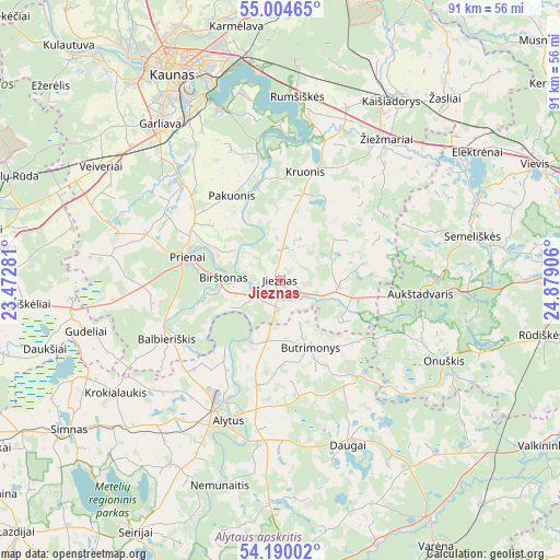
Jieznas GPS coordinates[2]
54° 35' 57.732" North, 24° 10' 33.348" East
| Map corner | latitude | longitude |
|---|---|---|
| Upper-left | 55.00465°, | 23.47281° |
| Center: | 54.59937°, | 24.17593° |
| Lower-right: | 54.19002°, | 24.87906° |
| Map W x H: | 90.6×90.6 km | = 56.3×56.3mi |
| max Lat: | 56.36149° ⇑90.3% North |
| Jieznas: | 54.59937° |
| min Lat: | ⇓9.7% South 54.01573° |
| min Long | Jieznas | max Long |
| 20.99651° | 24.17593° | 26.43984° |
| W 59.7%⇐ | ⇒40.3% E |
Elevation
Elevation of Jieznas is 110 m = 361 ft, and this is 19.3 m = 63 ft above average elevation for this country.
| Max E: |
204 m = 669 ft | 34.3% |
| Jieznas | 110 m 361 ft | |
| Avg. | 90.7 m = 298 ft | |
Min E: |
-1 m = -3 ft | 65.7% |
See also: Lithuania elevation on elevation.city.
Geographical zone
Jieznas is located in North temperate zone (between Tropic of Cancer and the Arctic Circle). Distance of this North polar circle is 1330.3 km =826.6 mi to North.| Distance of | km | miles | from Jieznas |
|---|---|---|---|
| North Pole | 3936.2 | 2445.8 | to North |
| Arctic Circle | 1330.3 | 826.6 | to North |
| Tropic Cancer | 3465 | 2153.1 | to South |
| Equator | 6070.9 | 3772.3 | to South |


Nearby cities:
15 places around Jieznas: (largest is in red/bold)
• Aleksotas
35.7 km =22.2 mi,  331°
331°
• Alytus
24.2 km =15 mi,  201°
201°
• Aukstadvaris
22.7 km =14.1 mi,  95°
95°
• Birštonas
9.2 km =5.7 mi,  275°
275°
• Dainava (Kaunas)
37.6 km =23.4 mi,  339°
339°
• Daugai
27.8 km =17.3 mi,  158°
158°
• Elektrėnai
37.5 km =23.3 mi,  56°
56°
• Garliava
31.5 km =19.6 mi,  321°
321°
• Kaišiadorys
35 km =21.7 mi,  32°
32°
• Kaunas
37.8 km =23.5 mi, 333°
• Linksmakalnis
23.7 km =14.7 mi, 317°
• Mastaiciai
32.5 km =20.2 mi, 319°
• Noreikiškės
38.3 km =23.8 mi, 326°
• Prienai
15.4 km =9.6 mi,  285°
285°
• Žiežmariai
28.7 km =17.8 mi,  36°
36°
Sources, notices
• [Note1] Compared only with cities in Lithuania existing in our database
• [Src1] Map data: © OpenStreetMap contributors (CC-BY-SA)
• [Src2] Other city data from geonames.org with taken over terms of usage.
• [Src3] Geographical zone / Annual Mean Temperature by Robert A. Rohde @ Wikipedia
