Ménaka geodata
Ménaka is a seat of a first-order administrative division; located in Mali in Africa/Bamako (GMT+0) time zone. With population of 9,110 people, there are 25 cities with bigger population in this country. Compared to other cities in Mali, 77% of cities are located further ↓South; 96.7% of cities are located further ←West and 65.6% of cities have higher elevation than Ménaka. Note1


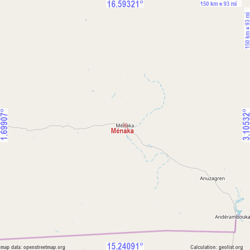
Ménaka GPS coordinates[2]
15° 55' 5.52" North, 2° 24' 7.92" East
| Map corner | latitude | longitude |
|---|---|---|
| Upper-left | 16.59321°, | 1.69907° |
| Center: | 15.9182°, | 2.4022° |
| Lower-right: | 15.24091°, | 3.10532° |
| Map W x H: | 150.4×150.4 km | = 93.5×93.5mi |
| max Lat: | 22.67443° ⇑23% North |
| Ménaka: | 15.9182° |
| min Lat: | ⇓77% South 10.55° |
| min Long | Ménaka | max Long |
| -11.44448° | 2.4022° | 3.14111° |
| W 96.7%⇐ | ⇒3.3% E |
Elevation
Elevation of Ménaka is 276 m = 906 ft, and this is 32 m = 105 ft below average elevation for this country.
| Max E: |
540 m = 1772 ft | 65.6% |
| Avg. | 308 m = 1010 ft | |
| Ménaka | 276 m = 906 ft | |
Min E: |
39 m = 128 ft | 34.4% |
See also: Mali elevation on elevation.city.
Geographical zone
Ménaka is located in North Torrid zone (between Equator and Tropic of Cancer). Distance of this Northern Tropic circle is 836 km =519.5 mi to North.| Distance of | km | miles | from Ménaka |
|---|---|---|---|
| North Pole | 8237.1 | 5118.3 | to North |
| Arctic Circle | 5631.2 | 3499.1 | to North |
| Tropic Cancer | 836 | 519.5 | to North |
| Equator | 1769.9 | 1099.8 | to South |


Nearby cities:
7 places around Ménaka: (largest is in red/bold)
• Abeïbara
362.3 km =225.1 mi,  348°
348°
• Ansongo
205.3 km =127.6 mi,  261°
261°
• Bourem
315.2 km =195.9 mi,  291°
291°
• Gao
264.3 km =164.2 mi,  278°
278°
• Inékar
79.1 km =49.2 mi,  86°
86°
• Kidal
299.7 km =186.2 mi,  339°
339°
• Ti-n-Essako
281.7 km =175 mi,  1°
1°
Sources, notices
• [Note1] Compared only with cities in Mali existing in our database
• [Src1] Map data: © OpenStreetMap contributors (CC-BY-SA)
• [Src2] Other city data from geonames.org with taken over terms of usage.
• [Src3] Geographical zone / Annual Mean Temperature by Robert A. Rohde @ Wikipedia
