Shiree geodata
Shiree (Övörhangay) is a seat of a second-order administrative division; located in Mongolia in Asia/Ulaanbaatar (GMT+8) time zone. In our database, there are 33 cities with bigger population. Compared to other cities in Mongolia, 81.6% of cities are located further ↑North; 53.4% of cities are located further ←West and 60.1% of cities have lower elevation than Shiree. Note1


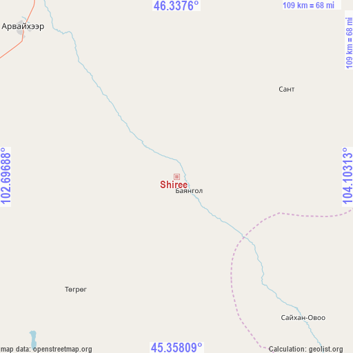
Shiree GPS coordinates[2]
45° 51' 0" North, 103° 24' 0" East
| Map corner | latitude | longitude |
|---|---|---|
| Upper-left | 46.3376°, | 102.69688° |
| Center: | 45.85°, | 103.4° |
| Lower-right: | 45.35809°, | 104.10313° |
| Map W x H: | 108.9×108.9 km | = 67.7×67.7mi |
| max Lat: | 51.50725° ⇑81.6% North |
| Shiree: | 45.85° |
| min Lat: | ⇓18.4% South 42.84199° |
| min Long | Shiree | max Long |
| 89.14358° | 103.4° | 118.51014° |
| W 53.4%⇐ | ⇒46.6% E |
Elevation
Elevation of Shiree is 1482 m = 4862 ft, and this is 65.5 m = 215 ft above average elevation for this country.
| Max E: |
2800 m = 9186 ft | 39.9% |
| Shiree | 1482 m 4862 ft | |
| Avg. | 1416.5 m = 4647 ft | |
Min E: |
619 m = 2031 ft | 60.1% |
See also: Mongolia elevation on elevation.city.
Geographical zone
Shiree is located in North temperate zone (between Tropic of Cancer and the Arctic Circle). Distance of this North polar circle is 2303.1 km =1431.1 mi to North.| Distance of | km | miles | from Shiree |
|---|---|---|---|
| North Pole | 4909 | 3050.3 | to North |
| Arctic Circle | 2303.1 | 1431.1 | to North |
| Tropic Cancer | 2492.1 | 1548.5 | to South |
| Equator | 5098 | 3167.7 | to South |


Nearby cities:
15 places around Shiree: (largest is in red/bold)
• Arguut
87.5 km =54.4 mi,  240°
240°
• Arvayheer
66.7 km =41.4 mi,  313°
313°
• Bayan-Ulaan
97.1 km =60.3 mi,  320°
320°
• Bumbat
90.7 km =56.4 mi,  37°
37°
• Hoolt
47.8 km =29.7 mi,  222°
222°
• Hujirt
123.4 km =76.7 mi,  47°
47°
• Hüremt
89.2 km =55.4 mi,  304°
304°
• Khujirt
126.1 km =78.4 mi,  337°
337°
• Mardzad
105 km =65.2 mi,  276°
276°
• Mayhan
43.3 km =26.9 mi, 51°
• Mönhbulag
100.5 km =62.4 mi,  5°
5°
• Ongi
59.1 km =36.7 mi,  138°
138°
• Ongi
110 km =68.4 mi, 308°
• Sangiyn Dalay
89.2 km =55.4 mi,  355°
355°
• Sangiyn Dalay
120.5 km =74.9 mi,  81°
81°
Sources, notices
• [Note1] Compared only with cities in Mongolia existing in our database
• [Src1] Map data: © OpenStreetMap contributors (CC-BY-SA)
• [Src2] Other city data from geonames.org with taken over terms of usage.
• [Src3] Geographical zone / Annual Mean Temperature by Robert A. Rohde @ Wikipedia
