Bayan-Ulaan geodata
Bayan-Ulaan (Övörhangay) is a seat of a second-order administrative division; located in Mongolia in Asia/Ulaanbaatar (GMT+8) time zone. In our database, there are 33 cities with bigger population. Compared to other cities in Mongolia, 69.6% of cities are located further ↑North; 50.3% of cities are located further →East and 83.4% of cities have lower elevation than Bayan-Ulaan. Note1


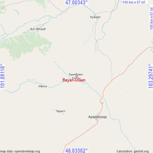
Bayan-Ulaan GPS coordinates[2]
46° 31' 18.408" North, 102° 35' 39.408" East
| Map corner | latitude | longitude |
|---|---|---|
| Upper-left | 47.00343°, | 101.89116° |
| Center: | 46.52178°, | 102.59428° |
| Lower-right: | 46.03582°, | 103.29741° |
| Map W x H: | 107.6×107.6 km | = 66.9×66.9mi |
| max Lat: | 51.50725° ⇑69.6% North |
| Bayan-Ulaan: | 46.52178° |
| min Lat: | ⇓30.4% South 42.84199° |
| min Long | Bayan-Ulaan | max Long |
| 89.14358° | 102.59428° | 118.51014° |
| W 49.7%⇐ | ⇒50.3% E |
Elevation
Elevation of Bayan-Ulaan is 1870 m = 6135 ft, and this is 453.5 m = 1488 ft above average elevation for this country.
| Max E: |
2800 m = 9186 ft | 16.6% |
| Bayan-Ulaan | 1870 m 6135 ft | |
| Avg. | 1416.5 m = 4647 ft | |
Min E: |
619 m = 2031 ft | 83.4% |
See also: Mongolia elevation on elevation.city.
Geographical zone
Bayan-Ulaan is located in North temperate zone (between Tropic of Cancer and the Arctic Circle). Distance of this North polar circle is 2228.4 km =1384.7 mi to North.| Distance of | km | miles | from Bayan-Ulaan |
|---|---|---|---|
| North Pole | 4834.3 | 3003.9 | to North |
| Arctic Circle | 2228.4 | 1384.7 | to North |
| Tropic Cancer | 2566.8 | 1594.9 | to South |
| Equator | 5172.7 | 3214.2 | to South |


Nearby cities:
15 places around Bayan-Ulaan: (largest is in red/bold)
• Arvayheer
31.8 km =19.8 mi,  154°
154°
• Harhorin
77.1 km =47.9 mi,  13°
13°
• Hotont
94 km =58.4 mi,  354°
354°
• Hüremt
26.9 km =16.7 mi,  205°
205°
• Kharkhorin
76.4 km =47.5 mi, 12°
• Khujirt
43.8 km =27.2 mi,  17°
17°
• Mardzad
76.1 km =47.3 mi, 213°
• Mayhan
107 km =66.5 mi,  116°
116°
• Mönhbulag
74.9 km =46.5 mi,  70°
70°
• Ongi
24.6 km =15.3 mi,  255°
255°
• Ongon
104.1 km =64.7 mi,  60°
60°
• Sangiyn Dalay
57 km =35.4 mi,  75°
75°
• Shiree
97.1 km =60.3 mi,  140°
140°
• Tsagaan-Ovoo
107 km =66.5 mi,  234°
234°
• Övt
42 km =26.1 mi,  321°
321°
Sources, notices
• [Note1] Compared only with cities in Mongolia existing in our database
• [Src1] Map data: © OpenStreetMap contributors (CC-BY-SA)
• [Src2] Other city data from geonames.org with taken over terms of usage.
• [Src3] Geographical zone / Annual Mean Temperature by Robert A. Rohde @ Wikipedia
