Għaxaq geodata
Għaxaq (Ħal Għaxaq) is a seat of a first-order administrative division; located in Malta in Europe/Malta (GMT+2) time zone. With population of 4,375 people, there are 31 cities with bigger population in this country. Compared to other cities in Malta, 90.1% of cities are located further ↑North; 85.9% of cities are located further ←West and 53.5% of cities have lower elevation than Għaxaq. Note1


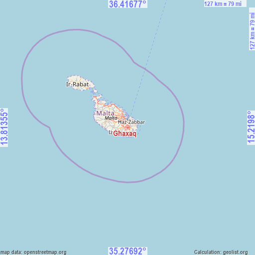
Għaxaq GPS coordinates[2]
35° 50' 56.004" North, 14° 31' 0.012" East
| Map corner | latitude | longitude |
|---|---|---|
| Upper-left | 36.41677°, | 13.81355° |
| Center: | 35.84889°, | 14.51667° |
| Lower-right: | 35.27692°, | 15.2198° |
| Map W x H: | 126.7×126.7 km | = 78.7×78.7mi |
| max Lat: | 36.07222° ⇑90.1% North |
| Għaxaq: | 35.84889° |
| min Lat: | ⇓9.9% South 35.82583° |
| min Long | Għaxaq | max Long |
| 14.20361° | 14.51667° | 14.56701° |
| W 85.9%⇐ | ⇒14.1% E |
Elevation
Elevation of Għaxaq is 73 m = 240 ft, and this is 5.1 m = 17 ft below average elevation for this country.
| Max E: |
231 m = 758 ft | 46.5% |
| Avg. | 78.1 m = 256 ft | |
| Għaxaq | 73 m = 240 ft | |
Min E: |
5 m = 16 ft | 53.5% |
See also: Malta elevation on elevation.city.
Geographical zone
Għaxaq is located in North temperate zone (between Tropic of Cancer and the Arctic Circle). Distance of this Northern Tropic circle is 1380.1 km =857.6 mi to South.| Distance of | km | miles | from Għaxaq |
|---|---|---|---|
| North Pole | 6021 | 3741.3 | to North |
| Arctic Circle | 3415.2 | 2122.1 | to North |
| Tropic Cancer | 1380.1 | 857.6 | to South |
| Equator | 3986 | 2476.8 | to South |


Nearby cities:
15 places around Għaxaq: (largest is in red/bold)
• Birżebbuġa
2.7 km =1.7 mi,  160°
160°
• Cospicua
4.2 km =2.6 mi,  13°
13°
• Fgura
2.4 km =1.5 mi,  352°
352°
• Gudja
1.2 km =0.7 mi,  271°
271°
• Kirkop
2.9 km =1.8 mi,  255°
255°
• Luqa
2.8 km =1.7 mi,  293°
293°
• Marsa
3.9 km =2.4 mi,  330°
330°
• Marsaxlokk
2.5 km =1.6 mi,  107°
107°
• Paola
3.1 km =1.9 mi, 329°
• Safi
3.4 km =2.1 mi,  238°
238°
• Santa Luċija
1.8 km =1.1 mi, 331°
• Senglea
4.3 km =2.7 mi,  0°
0°
• Tarxien
1.9 km =1.2 mi,  355°
355°
• Żabbar
3.4 km =2.1 mi,  28°
28°
• Żejtun
1.7 km =1.1 mi,  62°
62°
Sources, notices
• [Note1] Compared only with cities in Malta existing in our database
• [Src1] Map data: © OpenStreetMap contributors (CC-BY-SA)
• [Src2] Other city data from geonames.org with taken over terms of usage.
• [Src3] Geographical zone / Annual Mean Temperature by Robert A. Rohde @ Wikipedia
