Petite Case Noyale geodata
Petite Case Noyale (Black River) is a populated place; located in Mauritius in Indian/Mauritius (GMT+4) time zone. With population of 1,525 people, there are 93 cities with bigger population in this country. Compared to other cities in Mauritius, 85.9% of cities are located further ↑North; 98% of cities are located further →East and 90.9% of cities have higher elevation than Petite Case Noyale. Note1


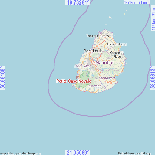
Petite Case Noyale GPS coordinates[2]
20° 23' 35.016" South, 57° 21' 54" East
| Map corner | latitude | longitude |
|---|---|---|
| Upper-left | -19.73261°, | 56.66188° |
| Center: | -20.39306°, | 57.365° |
| Lower-right: | -21.05069°, | 58.06813° |
| Map W x H: | 146.6×146.6 km | = 91.1×91.1mi |
| max Lat: | -10.38803° ⇑85.9% North |
| Petite Case Noyale: | -20.39306° |
| min Lat: | ⇓14.1% South -20.51667° |
| min Long | Petite Case Noy | max Long |
| 56.61795° | 57.365° | 63.41667° |
| W 2%⇐ | ⇒98% E |
Elevation
Elevation of Petite Case Noyale is 12 m = 39 ft, and this is 140.1 m = 460 ft below average elevation for this country.
| Max E: |
467 m = 1532 ft | 90.9% |
| Avg. | 152.1 m = 499 ft | |
| Petite Case Noyale | 12 m = 39 ft | |
Min E: |
1 m = 3 ft | 9.1% |
See also: Mauritius elevation on elevation.city.
Geographical zone
Petite Case Noyale is located in South Torrid zone (between Equator and Tropic of Capricorn). Distance of this Southern Tropic circle is 338.4 km =210.3 mi to South.| Distance of | km | miles | from Petite Case Noyale |
|---|---|---|---|
| Equator | 2267.5 | 1409 | to North |
| Tropic Capricorn | 338.4 | 210.3 | to South |
| Antarctic Circle | 5133.7 | 3189.9 | to South |
| South Pole | 7739.6 | 4809.2 | to South |


Nearby cities:
15 places around Petite Case Noyale: (largest is in red/bold)
• Bambous
15.8 km =9.8 mi,  15°
15°
• Beau Bassin-Rose Hill
20.7 km =12.9 mi,  30°
30°
• Cascavelle
12.6 km =7.8 mi, 20°
• Chamarel
3.8 km =2.4 mi,  148°
148°
• Chamouny
14.5 km =9 mi,  133°
133°
• Chemin Grenier
14.8 km =9.2 mi, 134°
• Curepipe
18.8 km =11.7 mi,  63°
63°
• Flic en Flac
13.2 km =8.2 mi,  359°
359°
• Grand Bois
18.9 km =11.7 mi,  98°
98°
• Grande Rivière Noire
3.6 km =2.2 mi,  1°
1°
• Nouvelle France
20.6 km =12.8 mi,  83°
83°
• Quatre Bornes
18.7 km =11.6 mi,  39°
39°
• Surinam
19.5 km =12.1 mi, 131°
• Tamarin
7.5 km =4.7 mi, 4°
• Vacoas
15.8 km =9.8 mi,  48°
48°
Sources, notices
• [Note1] Compared only with cities in Mauritius existing in our database
• [Src1] Map data: © OpenStreetMap contributors (CC-BY-SA)
• [Src2] Other city data from geonames.org with taken over terms of usage.
• [Src3] Geographical zone / Annual Mean Temperature by Robert A. Rohde @ Wikipedia
