Chino geodata
Chino (San Luis Potosí) is a populated place; located in Mexico in America/Mexico_City (GMT-6) time zone. With population of 754 people, there are 11619 cities with bigger population in this country. Compared to other cities in Mexico, 84.3% of cities are located further ↓South; 53.9% of cities are located further →East and 72.5% of cities have higher elevation than Chino. Note1


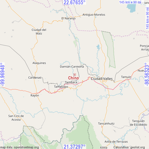
Chino GPS coordinates[2]
22° 1' 34.536" North, 99° 15' 58.86" West
| Map corner | latitude | longitude |
|---|---|---|
| Upper-left | 22.67655°, | -99.96948° |
| Center: | 22.02626°, | -99.26635° |
| Lower-right: | 21.37297°, | -98.56323° |
| Map W x H: | 144.9×144.9 km | = 90×90mi |
| max Lat: | 32.7° ⇑15.7% North |
| Chino: | 22.02626° |
| min Lat: | ⇓84.3% South 14.53588° |
| min Long | Chino | max Long |
| -117.105° | -99.26635° | -86.73105° |
| W 46.1%⇐ | ⇒53.9% E |
Elevation
Elevation of Chino is 313 m = 1027 ft, and this is 940.7 m = 3086 ft below average elevation for this country.
| Max E: |
3497 m = 11473 ft | 72.5% |
| Avg. | 1253.7 m = 4113 ft | |
| Chino | 313 m = 1027 ft | |
Min E: |
-1 m = -3 ft | 27.5% |
See also: Mexico elevation on elevation.city.
Geographical zone
Chino is located in North Torrid zone (between Equator and Tropic of Cancer). Distance of this Northern Tropic circle is 156.8 km =97.4 mi to North.| Distance of | km | miles | from Chino |
|---|---|---|---|
| North Pole | 7558 | 4696.3 | to North |
| Arctic Circle | 4952.1 | 3077.1 | to North |
| Tropic Cancer | 156.8 | 97.4 | to North |
| Equator | 2449.1 | 1521.8 | to South |


Nearby cities:
15 places around Chino: (largest is in red/bold)
• Abras del Corozo
11 km =6.8 mi,  184°
184°
• Agua Buena
15.2 km =9.4 mi,  240°
240°
• Coyoles
15.6 km =9.7 mi,  83°
83°
• Damian Carmona
8.3 km =5.2 mi,  341°
341°
• Ejido la Hincada
10.8 km =6.7 mi,  34°
34°
• El Jabalí
15.3 km =9.5 mi,  168°
168°
• El Ojite
16.8 km =10.4 mi,  112°
112°
• Estacion San Dieguito
4.9 km =3 mi, 113°
• Los Otates
11.4 km =7.1 mi, 110°
• Nuevo Crucitas
11.1 km =6.9 mi, 34°
• Ojo de Agua
17.3 km =10.7 mi, 114°
• Rascón
6.2 km =3.9 mi, 171°
• Tamasopo
17.3 km =10.7 mi,  229°
229°
• Tambaca
8.1 km =5 mi,  206°
206°
• Zocohuite
13.5 km =8.4 mi,  96°
96°
Sources, notices
• [Note1] Compared only with cities in Mexico existing in our database
• [Src1] Map data: © OpenStreetMap contributors (CC-BY-SA)
• [Src2] Other city data from geonames.org with taken over terms of usage.
• [Src3] Geographical zone / Annual Mean Temperature by Robert A. Rohde @ Wikipedia
