Coyoles geodata
Coyoles (San Luis Potosí) is a populated place; located in Mexico in America/Mexico_City (GMT-6) time zone. With population of 632 people, there are 13699 cities with bigger population in this country. Compared to other cities in Mexico, 84.5% of cities are located further ↓South; 51.3% of cities are located further →East and 78.4% of cities have higher elevation than Coyoles. Note1


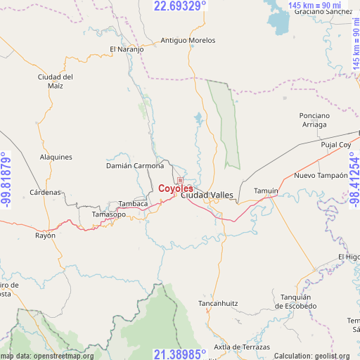
Coyoles GPS coordinates[2]
22° 2' 35.052" North, 99° 6' 56.376" West
| Map corner | latitude | longitude |
|---|---|---|
| Upper-left | 22.69329°, | -99.81879° |
| Center: | 22.04307°, | -99.11566° |
| Lower-right: | 21.38985°, | -98.41254° |
| Map W x H: | 144.9×144.9 km | = 90×90mi |
| max Lat: | 32.7° ⇑15.5% North |
| Coyoles: | 22.04307° |
| min Lat: | ⇓84.5% South 14.53588° |
| min Long | Coyoles | max Long |
| -117.105° | -99.11566° | -86.73105° |
| W 48.7%⇐ | ⇒51.3% E |
Elevation
Elevation of Coyoles is 122 m = 400 ft, and this is 1131.7 m = 3713 ft below average elevation for this country.
| Max E: |
3497 m = 11473 ft | 78.4% |
| Avg. | 1253.7 m = 4113 ft | |
| Coyoles | 122 m = 400 ft | |
Min E: |
-1 m = -3 ft | 21.6% |
See also: Mexico elevation on elevation.city.
Geographical zone
Coyoles is located in North Torrid zone (between Equator and Tropic of Cancer). Distance of this Northern Tropic circle is 155 km =96.3 mi to North.| Distance of | km | miles | from Coyoles |
|---|---|---|---|
| North Pole | 7556.1 | 4695.1 | to North |
| Arctic Circle | 4950.2 | 3075.9 | to North |
| Tropic Cancer | 155 | 96.3 | to North |
| Equator | 2451 | 1523 | to South |


Nearby cities:
15 places around Coyoles: (largest is in red/bold)
• Chino
15.6 km =9.7 mi,  263°
263°
• Ciudad Valles
12 km =7.5 mi,  115°
115°
• Ejido la Hincada
11.8 km =7.3 mi,  306°
306°
• El Ojite
8.2 km =5.1 mi,  179°
179°
• Estacion San Dieguito
11.7 km =7.3 mi,  250°
250°
• La Lima
12.9 km =8 mi,  174°
174°
• La Subida
15.4 km =9.6 mi, 173°
• Los Otates
7.6 km =4.7 mi,  219°
219°
• Los Sabinos Número Dos
15.7 km =9.8 mi,  66°
66°
• Nuevo Crucitas
11.7 km =7.3 mi, 308°
• Ojo de Agua
9.1 km =5.7 mi, 179°
• Rancho Nuevo
18.8 km =11.7 mi, 171°
• Rascón
16.7 km =10.4 mi,  241°
241°
• San Antonio Huichimal
11.6 km =7.2 mi, 175°
• Zocohuite
4 km =2.5 mi,  211°
211°
Sources, notices
• [Note1] Compared only with cities in Mexico existing in our database
• [Src1] Map data: © OpenStreetMap contributors (CC-BY-SA)
• [Src2] Other city data from geonames.org with taken over terms of usage.
• [Src3] Geographical zone / Annual Mean Temperature by Robert A. Rohde @ Wikipedia
