Tres Lagunas geodata
Tres Lagunas (Querétaro) is a populated place; located in Mexico in America/Mexico_City (GMT-6) time zone. With population of 611 people, there are 14112 cities with bigger population in this country. Compared to other cities in Mexico, 80.3% of cities are located further ↓South; 52.9% of cities are located further →East and 56.4% of cities have lower elevation than Tres Lagunas. Note1


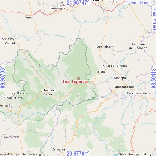
Tres Lagunas GPS coordinates[2]
21° 20' 2.4" North, 99° 12' 15.3" West
| Map corner | latitude | longitude |
|---|---|---|
| Upper-left | 21.98747°, | -99.90738° |
| Center: | 21.334°, | -99.20425° |
| Lower-right: | 20.67761°, | -98.50113° |
| Map W x H: | 145.6×145.6 km | = 90.5×90.5mi |
| max Lat: | 32.7° ⇑19.7% North |
| Tres Lagunas: | 21.334° |
| min Lat: | ⇓80.3% South 14.53588° |
| min Long | Tres Lagunas | max Long |
| -117.105° | -99.20425° | -86.73105° |
| W 47.1%⇐ | ⇒52.9% E |
Elevation
Elevation of Tres Lagunas is 1636 m = 5367 ft, and this is 382.3 m = 1254 ft above average elevation for this country.
| Max E: |
3497 m = 11473 ft | 43.6% |
| Tres Lagunas | 1636 m 5367 ft | |
| Avg. | 1253.7 m = 4113 ft | |
Min E: |
-1 m = -3 ft | 56.4% |
See also: Mexico elevation on elevation.city.
Geographical zone
Tres Lagunas is located in North Torrid zone (between Equator and Tropic of Cancer). Distance of this Northern Tropic circle is 233.8 km =145.3 mi to North.| Distance of | km | miles | from Tres Lagunas |
|---|---|---|---|
| North Pole | 7634.9 | 4744.1 | to North |
| Arctic Circle | 5029.1 | 3124.9 | to North |
| Tropic Cancer | 233.8 | 145.3 | to North |
| Equator | 2372.1 | 1474 | to South |


Nearby cities:
15 places around Tres Lagunas: (largest is in red/bold)
• Agua Zarca
17.3 km =10.7 mi,  137°
137°
• El Humo
15.3 km =9.5 mi, 137°
• El Lobo
10 km =6.2 mi,  117°
117°
• Encino Solo
10.9 km =6.8 mi,  215°
215°
• La Lagunita
11.2 km =7 mi,  210°
210°
• La Vuelta
6.6 km =4.1 mi, 214°
• Landa de Matamoros
20.5 km =12.7 mi, 215°
• Neblinas
16.7 km =10.4 mi,  114°
114°
• Nuevo Miramar
18.5 km =11.5 mi,  73°
73°
• Otates
21 km =13 mi,  183°
183°
• Pinalito de la Cruz
3.5 km =2.2 mi, 116°
• Potrerillos
13.7 km =8.5 mi,  101°
101°
• Tilaco
18.9 km =11.7 mi, 176°
• Valle Verde
20.2 km =12.6 mi,  9°
9°
• Valle de Guadalupe
4.9 km =3 mi, 6°
Sources, notices
• [Note1] Compared only with cities in Mexico existing in our database
• [Src1] Map data: © OpenStreetMap contributors (CC-BY-SA)
• [Src2] Other city data from geonames.org with taken over terms of usage.
• [Src3] Geographical zone / Annual Mean Temperature by Robert A. Rohde @ Wikipedia
