Nuevo Miramar geodata
Nuevo Miramar (San Luis Potosí) is a populated place; located in Mexico in America/Mexico_City (GMT-6) time zone. With population of 780 people, there are 11196 cities with bigger population in this country. Compared to other cities in Mexico, 80.7% of cities are located further ↓South; 50.3% of cities are located further →East and 52.1% of cities have higher elevation than Nuevo Miramar. Note1


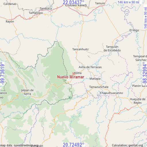
Nuevo Miramar GPS coordinates[2]
21° 22' 51.996" North, 99° 1' 59.016" West
| Map corner | latitude | longitude |
|---|---|---|
| Upper-left | 22.03437°, | -99.73619° |
| Center: | 21.38111°, | -99.03306° |
| Lower-right: | 20.72492°, | -98.32994° |
| Map W x H: | 145.6×145.6 km | = 90.5×90.5mi |
| max Lat: | 32.7° ⇑19.3% North |
| Nuevo Miramar: | 21.38111° |
| min Lat: | ⇓80.7% South 14.53588° |
| min Long | Nuevo Miramar | max Long |
| -117.105° | -99.03306° | -86.73105° |
| W 49.7%⇐ | ⇒50.3% E |
Elevation
Elevation of Nuevo Miramar is 1331 m = 4367 ft, and this is 77.3 m = 254 ft above average elevation for this country.
| Max E: |
3497 m = 11473 ft | 52.1% |
| Nuevo Miramar | 1331 m 4367 ft | |
| Avg. | 1253.7 m = 4113 ft | |
Min E: |
-1 m = -3 ft | 47.9% |
See also: Mexico elevation on elevation.city.
Geographical zone
Nuevo Miramar is located in North Torrid zone (between Equator and Tropic of Cancer). Distance of this Northern Tropic circle is 228.6 km =142 mi to North.| Distance of | km | miles | from Nuevo Miramar |
|---|---|---|---|
| North Pole | 7629.7 | 4740.9 | to North |
| Arctic Circle | 5023.8 | 3121.6 | to North |
| Tropic Cancer | 228.6 | 142 | to North |
| Equator | 2377.4 | 1477.2 | to South |


Nearby cities:
15 places around Nuevo Miramar: (largest is in red/bold)
• Apetzco
2.7 km =1.7 mi,  58°
58°
• Cuartillo Nuevo
9.9 km =6.2 mi,  107°
107°
• El Cañón
6.9 km =4.3 mi,  25°
25°
• Iztacapa
9.5 km =5.9 mi,  97°
97°
• La Herradura
11 km =6.8 mi,  51°
51°
• Pemoxco
10 km =6.2 mi, 102°
• Peña Blanca
7.5 km =4.7 mi, 45°
• Pilateno
8.6 km =5.3 mi,  129°
129°
• Potrerillos
9 km =5.6 mi,  208°
208°
• Sabino
9.6 km =6 mi,  136°
136°
• San Antonio Huitzquilico (Barrio Centro)
11.3 km =7 mi,  18°
18°
• San Pedro Huitzquilico
8.7 km =5.4 mi,  14°
14°
• Tlacuapa (Temascal)
10.1 km =6.3 mi, 64°
• Uxtuapan
6.4 km =4 mi, 108°
• Xilitla
4.5 km =2.8 mi,  81°
81°
Sources, notices
• [Note1] Compared only with cities in Mexico existing in our database
• [Src1] Map data: © OpenStreetMap contributors (CC-BY-SA)
• [Src2] Other city data from geonames.org with taken over terms of usage.
• [Src3] Geographical zone / Annual Mean Temperature by Robert A. Rohde @ Wikipedia
