Landa de Matamoros geodata
Landa de Matamoros (Querétaro) is a seat of a second-order administrative division; located in Mexico in America/Mexico_City (GMT-6) time zone. With population of 1,609 people, there are 5377 cities with bigger population in this country. Compared to other cities in Mexico, 79% of cities are located further ↓South; 54.4% of cities are located further →East and 59.5% of cities have higher elevation than Landa de Matamoros. Note1


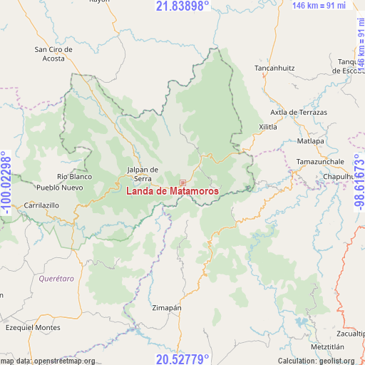
Landa de Matamoros GPS coordinates[2]
21° 11' 5.424" North, 99° 19' 11.46" West
| Map corner | latitude | longitude |
|---|---|---|
| Upper-left | 21.83898°, | -100.02298° |
| Center: | 21.18484°, | -99.31985° |
| Lower-right: | 20.52779°, | -98.61673° |
| Map W x H: | 145.8×145.8 km | = 90.6×90.6mi |
| max Lat: | 32.7° ⇑21% North |
| Landa de Matamoros: | 21.18484° |
| min Lat: | ⇓79% South 14.53588° |
| min Long | Landa de Matamo | max Long |
| -117.105° | -99.31985° | -86.73105° |
| W 45.6%⇐ | ⇒54.4% E |
Elevation
Elevation of Landa de Matamoros is 1027 m = 3369 ft, and this is 226.7 m = 744 ft below average elevation for this country.
| Max E: |
3497 m = 11473 ft | 59.5% |
| Avg. | 1253.7 m = 4113 ft | |
| Landa de Matamoros | 1027 m = 3369 ft | |
Min E: |
-1 m = -3 ft | 40.5% |
See also: Mexico elevation on elevation.city.
Geographical zone
Landa de Matamoros is located in North Torrid zone (between Equator and Tropic of Cancer). Distance of this Northern Tropic circle is 250.4 km =155.6 mi to North.| Distance of | km | miles | from Landa de Matamoros |
|---|---|---|---|
| North Pole | 7651.5 | 4754.4 | to North |
| Arctic Circle | 5045.6 | 3135.2 | to North |
| Tropic Cancer | 250.4 | 155.6 | to North |
| Equator | 2355.5 | 1463.6 | to South |


Nearby cities:
15 places around Landa de Matamoros: (largest is in red/bold)
• El Humo
22.9 km =14.2 mi,  76°
76°
• El Lindero
21.5 km =13.4 mi,  299°
299°
• Encino Solo
9.6 km =6 mi,  35°
35°
• Jalpan
16.1 km =10 mi,  283°
283°
• Jiliapan
22.8 km =14.2 mi,  186°
186°
• La Lagunita
9.4 km =5.8 mi, 42°
• La Misión
22.5 km =14 mi,  115°
115°
• La Vuelta
13.9 km =8.6 mi, 36°
• Las Duraznos
23 km =14.3 mi, 123°
• Otates
11.6 km =7.2 mi,  112°
112°
• Pacula
15.1 km =9.4 mi,  170°
170°
• Pinalito de la Cruz
21.3 km =13.2 mi,  45°
45°
• Tilaco
13.2 km =8.2 mi,  100°
100°
• Tres Lagunas
20.5 km =12.7 mi, 35°
• Vicente Guerrero
14.8 km =9.2 mi,  176°
176°
Sources, notices
• [Note1] Compared only with cities in Mexico existing in our database
• [Src1] Map data: © OpenStreetMap contributors (CC-BY-SA)
• [Src2] Other city data from geonames.org with taken over terms of usage.
• [Src3] Geographical zone / Annual Mean Temperature by Robert A. Rohde @ Wikipedia
