Tres Garantías geodata
Tres Garantías (Quintana Roo) is a populated place; located in Mexico in America/Cancun (GMT-5) time zone. With population of 790 people, there are 11052 cities with bigger population in this country. Compared to other cities in Mexico, 76.3% of cities are located further ↑North; 98.8% of cities are located further ←West and 77.1% of cities have higher elevation than Tres Garantías. Note1


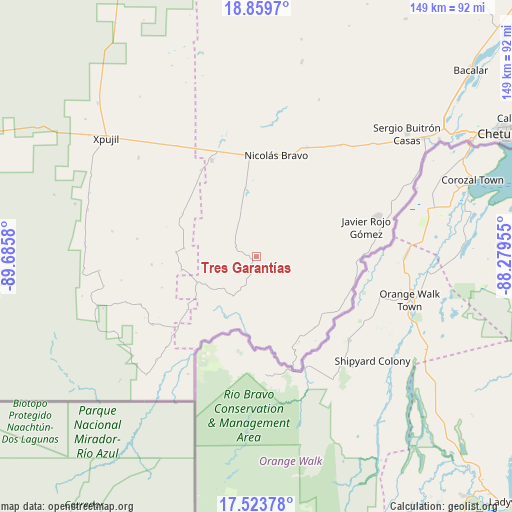
Tres Garantías GPS coordinates[2]
18° 11' 34.872" North, 88° 58' 57.612" West
| Map corner | latitude | longitude |
|---|---|---|
| Upper-left | 18.8597°, | -89.6858° |
| Center: | 18.19302°, | -88.98267° |
| Lower-right: | 17.52378°, | -88.27955° |
| Map W x H: | 148.5×148.5 km | = 92.3×92.3mi |
| max Lat: | 32.7° ⇑76.3% North |
| Tres Garantías: | 18.19302° |
| min Lat: | ⇓23.7% South 14.53588° |
| min Long | Tres Garantías | max Long |
| -117.105° | -88.98267° | -86.73105° |
| W 98.8%⇐ | ⇒1.2% E |
Elevation
Elevation of Tres Garantías is 149 m = 489 ft, and this is 1104.7 m = 3624 ft below average elevation for this country.
| Max E: |
3497 m = 11473 ft | 77.1% |
| Avg. | 1253.7 m = 4113 ft | |
| Tres Garantías | 149 m = 489 ft | |
Min E: |
-1 m = -3 ft | 22.9% |
See also: Mexico elevation on elevation.city.
Geographical zone
Tres Garantías is located in North Torrid zone (between Equator and Tropic of Cancer). Distance of this Northern Tropic circle is 583 km =362.3 mi to North.| Distance of | km | miles | from Tres Garantías |
|---|---|---|---|
| North Pole | 7984.2 | 4961.2 | to North |
| Arctic Circle | 5378.3 | 3341.9 | to North |
| Tropic Cancer | 583 | 362.3 | to North |
| Equator | 2022.9 | 1257 | to South |


Nearby cities:
15 places around Tres Garantías: (largest is in red/bold)
• Cacao
30.4 km =18.9 mi,  89°
89°
• Caobas
30.8 km =19.1 mi,  335°
335°
• Cocoyol
31 km =19.3 mi,  95°
95°
• Francisco Villa
34.9 km =21.7 mi,  24°
24°
• Javier Rojo Gómez
33.1 km =20.6 mi,  74°
74°
• Jesús González Ortega
46.5 km =28.9 mi,  45°
45°
• Jose Narciso Rovirosa
28.8 km =17.9 mi,  109°
109°
• La Unión
34.4 km =21.4 mi,  161°
161°
• Nachi Cocom
40.4 km =25.1 mi,  37°
37°
• Nicolás Bravo
30.1 km =18.7 mi,  11°
11°
• Pedro Joaquín Coldwell
34.6 km =21.5 mi,  78°
78°
• Pucté
33.6 km =20.9 mi, 82°
• Sabidos
45.5 km =28.3 mi, 66°
• San Francisco Botes
29.3 km =18.2 mi, 107°
• Álvaro Obregón
36.9 km =22.9 mi, 71°
Sources, notices
• [Note1] Compared only with cities in Mexico existing in our database
• [Src1] Map data: © OpenStreetMap contributors (CC-BY-SA)
• [Src2] Other city data from geonames.org with taken over terms of usage.
• [Src3] Geographical zone / Annual Mean Temperature by Robert A. Rohde @ Wikipedia
