Nachi Cocom geodata
Nachi Cocom (Quintana Roo) is a populated place; located in Mexico in America/Cancun (GMT-5) time zone. With population of 833 people, there are 10503 cities with bigger population in this country. Compared to other cities in Mexico, 72.8% of cities are located further ↑North; 99% of cities are located further ←West and 82.9% of cities have higher elevation than Nachi Cocom. Note1


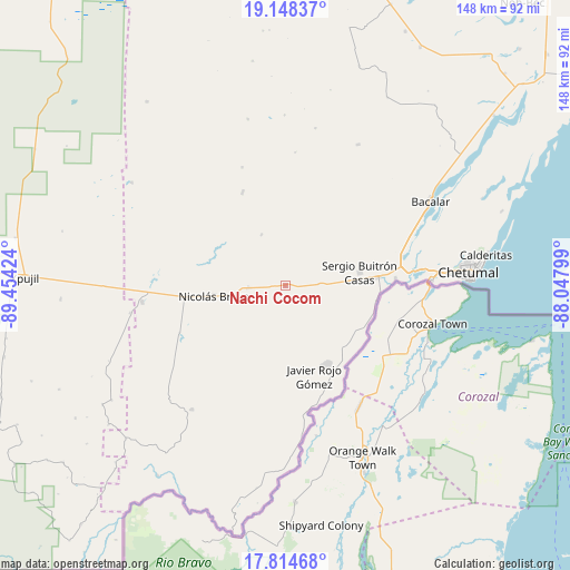
Nachi Cocom GPS coordinates[2]
18° 28' 58.152" North, 88° 45' 3.996" West
| Map corner | latitude | longitude |
|---|---|---|
| Upper-left | 19.14837°, | -89.45424° |
| Center: | 18.48282°, | -88.75111° |
| Lower-right: | 17.81468°, | -88.04799° |
| Map W x H: | 148.3×148.3 km | = 92.1×92.1mi |
| max Lat: | 32.7° ⇑72.8% North |
| Nachi Cocom: | 18.48282° |
| min Lat: | ⇓27.2% South 14.53588° |
| min Long | Nachi Cocom | max Long |
| -117.105° | -88.75111° | -86.73105° |
| W 99%⇐ | ⇒1% E |
Elevation
Elevation of Nachi Cocom is 61 m = 200 ft, and this is 1192.7 m = 3913 ft below average elevation for this country.
| Max E: |
3497 m = 11473 ft | 82.9% |
| Avg. | 1253.7 m = 4113 ft | |
| Nachi Cocom | 61 m = 200 ft | |
Min E: |
-1 m = -3 ft | 17.1% |
See also: Mexico elevation on elevation.city.
Geographical zone
Nachi Cocom is located in North Torrid zone (between Equator and Tropic of Cancer). Distance of this Northern Tropic circle is 550.8 km =342.3 mi to North.| Distance of | km | miles | from Nachi Cocom |
|---|---|---|---|
| North Pole | 7952 | 4941.1 | to North |
| Arctic Circle | 5346.1 | 3321.9 | to North |
| Tropic Cancer | 550.8 | 342.3 | to North |
| Equator | 2055.1 | 1277 | to South |


Nearby cities:
15 places around Nachi Cocom: (largest is in red/bold)
• Allende
23.4 km =14.5 mi,  118°
118°
• Carlos A. Madrazo
23.9 km =14.9 mi,  84°
84°
• Francisco Villa
9.8 km =6.1 mi,  267°
267°
• Javier Rojo Gómez
24.4 km =15.2 mi,  162°
162°
• Jesús González Ortega
8.6 km =5.3 mi,  86°
86°
• Morocoy
14.8 km =9.2 mi,  334°
334°
• Nicolás Bravo
18.8 km =11.7 mi,  261°
261°
• Palmar
23.6 km =14.7 mi,  99°
99°
• Ramonal
24.1 km =15 mi,  106°
106°
• Sabidos
22.2 km =13.8 mi,  128°
128°
• Sacxán
24.6 km =15.3 mi, 94°
• San Pedro Peralta
26.6 km =16.5 mi,  335°
335°
• Sergio Butrón Casas
19.5 km =12.1 mi, 79°
• Ucum
24.6 km =15.3 mi, 84°
• Álvaro Obregón
23 km =14.3 mi,  152°
152°
Sources, notices
• [Note1] Compared only with cities in Mexico existing in our database
• [Src1] Map data: © OpenStreetMap contributors (CC-BY-SA)
• [Src2] Other city data from geonames.org with taken over terms of usage.
• [Src3] Geographical zone / Annual Mean Temperature by Robert A. Rohde @ Wikipedia
