Sabidos geodata
Sabidos (Quintana Roo) is a populated place; located in Mexico in America/Cancun (GMT-5) time zone. With population of 1,342 people, there are 6480 cities with bigger population in this country. Compared to other cities in Mexico, 74.3% of cities are located further ↑North; 99.1% of cities are located further ←West and 83.5% of cities have higher elevation than Sabidos. Note1


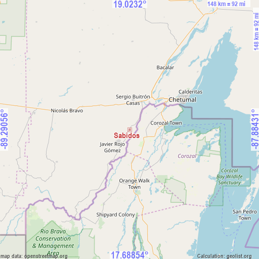
Sabidos GPS coordinates[2]
18° 21' 25.776" North, 88° 35' 14.748" West
| Map corner | latitude | longitude |
|---|---|---|
| Upper-left | 19.0232°, | -89.29056° |
| Center: | 18.35716°, | -88.58743° |
| Lower-right: | 17.68854°, | -87.88431° |
| Map W x H: | 148.4×148.4 km | = 92.2×92.2mi |
| max Lat: | 32.7° ⇑74.3% North |
| Sabidos: | 18.35716° |
| min Lat: | ⇓25.7% South 14.53588° |
| min Long | Sabidos | max Long |
| -117.105° | -88.58743° | -86.73105° |
| W 99.1%⇐ | ⇒0.90000000000001% E |
Elevation
Elevation of Sabidos is 55 m = 180 ft, and this is 1198.7 m = 3933 ft below average elevation for this country.
| Max E: |
3497 m = 11473 ft | 83.5% |
| Avg. | 1253.7 m = 4113 ft | |
| Sabidos | 55 m = 180 ft | |
Min E: |
-1 m = -3 ft | 16.5% |
See also: Mexico elevation on elevation.city.
Geographical zone
Sabidos is located in North Torrid zone (between Equator and Tropic of Cancer). Distance of this Northern Tropic circle is 564.8 km =351 mi to North.| Distance of | km | miles | from Sabidos |
|---|---|---|---|
| North Pole | 7965.9 | 4949.8 | to North |
| Arctic Circle | 5360 | 3330.5 | to North |
| Tropic Cancer | 564.8 | 351 | to North |
| Equator | 2041.1 | 1268.3 | to South |


Nearby cities:
15 places around Sabidos: (largest is in red/bold)
• Allende
4.5 km =2.8 mi,  48°
48°
• Cacao
21.4 km =13.3 mi,  212°
212°
• Carlos A. Madrazo
17.4 km =10.8 mi,  22°
22°
• Javier Rojo Gómez
13.5 km =8.4 mi,  226°
226°
• Jesús González Ortega
16.9 km =10.5 mi,  329°
329°
• Juan Sarabia
19.5 km =12.1 mi,  35°
35°
• Nachi Cocom
22.2 km =13.8 mi,  308°
308°
• Palmar
11.8 km =7.3 mi,  30°
30°
• Pedro Joaquín Coldwell
13.7 km =8.5 mi, 214°
• Pucté
16.3 km =10.1 mi, 211°
• Ramonal
9 km =5.6 mi, 39°
• Sacxán
14.1 km =8.8 mi, 30°
• Sergio Butrón Casas
17.5 km =10.9 mi,  6°
6°
• Ucum
17.7 km =11 mi, 24°
• Álvaro Obregón
9.4 km =5.8 mi, 226°
Sources, notices
• [Note1] Compared only with cities in Mexico existing in our database
• [Src1] Map data: © OpenStreetMap contributors (CC-BY-SA)
• [Src2] Other city data from geonames.org with taken over terms of usage.
• [Src3] Geographical zone / Annual Mean Temperature by Robert A. Rohde @ Wikipedia
