Santo Domingo Tomaltepec geodata
Santo Domingo Tomaltepec (Oaxaca) is a seat of a second-order administrative division; located in Mexico in America/Mexico_City (GMT-6) time zone. With population of 2,483 people, there are 3561 cities with bigger population in this country. Compared to other cities in Mexico, 88.1% of cities are located further ↑North; 79% of cities are located further ←West and 54.9% of cities have lower elevation than Santo Domingo Tomaltepec. Note1
Current local time in Santo Domingo Tomaltepec:
08:26 AM, WednesdayDifference from your time zone: hours


Santo Domingo Tomaltepec GPS coordinates[2]
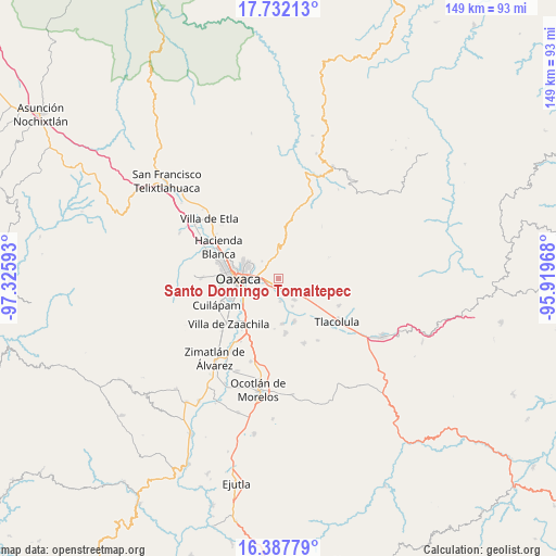
17° 3' 40.212" North, 96° 37' 22.08" West
| Map corner | latitude | longitude |
|---|---|---|
| Upper-left | 17.73213°, | -97.32593° |
| Center: | 17.06117°, | -96.6228° |
| Lower-right: | 16.38779°, | -95.91968° |
| Map W x H: | 149.5×149.5 km | = 92.9×92.9mi |
| max Lat: | 32.7° ⇑88.1% North |
| Santo Domingo Tomaltepec: | 17.06117° |
| min Lat: | ⇓11.9% South 14.53588° |
| min Long | Santo Domingo T | max Long |
| -117.105° | -96.6228° | -86.73105° |
| W 79%⇐ | ⇒21% E |
Elevation
Elevation of Santo Domingo Tomaltepec is 1587 m = 5207 ft, and this is 333.3 m = 1094 ft above average elevation for this country.
| Max E: |
3497 m = 11473 ft | 45.1% |
| Santo Domingo Tomaltepec | 1587 m 5207 ft | |
| Avg. | 1253.7 m = 4113 ft | |
Min E: |
-1 m = -3 ft | 54.9% |
See also: Mexico elevation on elevation.city.
Geographical zone
Santo Domingo Tomaltepec is located in North Torrid zone (between Equator and Tropic of Cancer). Distance of this Northern Tropic circle is 708.9 km =440.5 mi to North.| Distance of | km | miles | from Santo Domingo Tomaltepec |
|---|---|---|---|
| North Pole | 8110 | 5039.3 | to North |
| Arctic Circle | 5504.1 | 3420.1 | to North |
| Tropic Cancer | 708.9 | 440.5 | to North |
| Equator | 1897 | 1178.7 | to South |


Nearby cities:
15 places around Santo Domingo Tomaltepec: (largest is in red/bold)
• El Rosario
7.6 km =4.7 mi,  254°
254°
• Rojas de Cuauhtémoc
6.2 km =3.9 mi,  176°
176°
• San Agustín Yatareni
5.1 km =3.2 mi,  296°
296°
• San Andrés Huayápam
6.5 km =4 mi,  315°
315°
• San Antonio de la Cal
9 km =5.6 mi, 246°
• San Francisco Lachigoló
5.6 km =3.5 mi,  153°
153°
• San Francisco Tutla
4.9 km =3 mi,  282°
282°
• San Jerónimo Tlacochahuaya
7.2 km =4.5 mi,  143°
143°
• San Sebastián Abasolo
8.4 km =5.2 mi, 152°
• San Sebastián Tutla
5.7 km =3.5 mi,  266°
266°
• Santa Cruz Amilpas
6.4 km =4 mi, 267°
• Santa María Guelacé
7 km =4.3 mi,  162°
162°
• Santa María del Tule
2.1 km =1.3 mi,  221°
221°
• Santiago Ixtaltepec
7.1 km =4.4 mi,  120°
120°
• Tlalixtac de Cabrera
2.8 km =1.7 mi,  293°
293°
Sources, notices
• [Note1] Compared only with cities in Mexico existing in our database
• [Src1] Map data: © OpenStreetMap contributors (CC-BY-SA)
• [Src2] Other city data from geonames.org with taken over terms of usage.
• [Src3] Geographical zone / Annual Mean Temperature by Robert A. Rohde @ Wikipedia
