San Sebastián Tutla geodata
San Sebastián Tutla (Oaxaca) is a populated place; located in Mexico in America/Mexico_City (GMT-6) time zone. With population of 4,534 people, there are 2028 cities with bigger population in this country. Compared to other cities in Mexico, 88.1% of cities are located further ↑North; 78.6% of cities are located further ←West and 53.2% of cities have lower elevation than San Sebastián Tutla. Note1


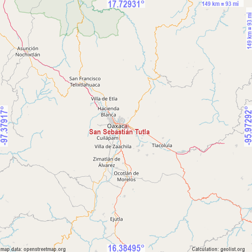
San Sebastián Tutla GPS coordinates[2]
17° 3' 30.024" North, 96° 40' 33.744" West
| Map corner | latitude | longitude |
|---|---|---|
| Upper-left | 17.72931°, | -97.37917° |
| Center: | 17.05834°, | -96.67604° |
| Lower-right: | 16.38495°, | -95.97292° |
| Map W x H: | 149.5×149.5 km | = 92.9×92.9mi |
| max Lat: | 32.7° ⇑88.1% North |
| San Sebastián Tutla: | 17.05834° |
| min Lat: | ⇓11.9% South 14.53588° |
| min Long | San Sebastián | max Long |
| -117.105° | -96.67604° | -86.73105° |
| W 78.6%⇐ | ⇒21.4% E |
Elevation
Elevation of San Sebastián Tutla is 1545 m = 5069 ft, and this is 291.3 m = 956 ft above average elevation for this country.
| Max E: |
3497 m = 11473 ft | 46.8% |
| San Sebastián Tutla | 1545 m 5069 ft | |
| Avg. | 1253.7 m = 4113 ft | |
Min E: |
-1 m = -3 ft | 53.2% |
See also: Mexico elevation on elevation.city.
Geographical zone
San Sebastián Tutla is located in North Torrid zone (between Equator and Tropic of Cancer). Distance of this Northern Tropic circle is 709.2 km =440.7 mi to North.| Distance of | km | miles | from San Sebastián Tutla |
|---|---|---|---|
| North Pole | 8110.4 | 5039.6 | to North |
| Arctic Circle | 5504.5 | 3420.3 | to North |
| Tropic Cancer | 709.2 | 440.7 | to North |
| Equator | 1896.7 | 1178.6 | to South |


Nearby cities:
15 places around San Sebastián Tutla: (largest is in red/bold)
• El Rosario
2.4 km =1.5 mi,  224°
224°
• Oaxaca
5.1 km =3.2 mi,  278°
278°
• Rojas de Cuauhtémoc
8.4 km =5.2 mi,  133°
133°
• San Agustin de las Juntas
6.9 km =4.3 mi,  209°
209°
• San Agustín Yatareni
2.8 km =1.7 mi,  22°
22°
• San Agustín de las Juntas
6.4 km =4 mi, 216°
• San Andrés Huayápam
5.1 km =3.2 mi,  12°
12°
• San Antonio de la Cal
4.2 km =2.6 mi, 219°
• San Francisco Tutla
1.6 km =1 mi,  31°
31°
• Santa Cruz Amilpas
0.8 km =0.5 mi,  269°
269°
• Santa Cruz Xoxocotlán
7.1 km =4.4 mi,  243°
243°
• Santa María del Tule
4.5 km =2.8 mi,  106°
106°
• Santo Domingo Tomaltepec
5.7 km =3.5 mi,  86°
86°
• Tercera Sección la Nopalera
4.7 km =2.9 mi, 209°
• Tlalixtac de Cabrera
3.4 km =2.1 mi,  65°
65°
Sources, notices
• [Note1] Compared only with cities in Mexico existing in our database
• [Src1] Map data: © OpenStreetMap contributors (CC-BY-SA)
• [Src2] Other city data from geonames.org with taken over terms of usage.
• [Src3] Geographical zone / Annual Mean Temperature by Robert A. Rohde @ Wikipedia
