San Andrés Huayápam geodata
San Andrés Huayápam (Oaxaca) is a seat of a second-order administrative division; located in Mexico in America/Mexico_City (GMT-6) time zone. With population of 4,344 people, there are 2113 cities with bigger population in this country. Compared to other cities in Mexico, 87.6% of cities are located further ↑North; 78.7% of cities are located further ←West and 59.2% of cities have lower elevation than San Andrés Huayápam. Note1


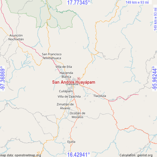
San Andrés Huayápam GPS coordinates[2]
17° 6' 9.504" North, 96° 39' 56.016" West
| Map corner | latitude | longitude |
|---|---|---|
| Upper-left | 17.77345°, | -97.36869° |
| Center: | 17.10264°, | -96.66556° |
| Lower-right: | 16.42941°, | -95.96244° |
| Map W x H: | 149.4×149.4 km | = 92.8×92.8mi |
| max Lat: | 32.7° ⇑87.6% North |
| San Andrés Huayápam: | 17.10264° |
| min Lat: | ⇓12.4% South 14.53588° |
| min Long | San Andrés Hua | max Long |
| -117.105° | -96.66556° | -86.73105° |
| W 78.7%⇐ | ⇒21.3% E |
Elevation
Elevation of San Andrés Huayápam is 1713 m = 5620 ft, and this is 459.3 m = 1507 ft above average elevation for this country.
| Max E: |
3497 m = 11473 ft | 40.8% |
| San Andrés Huayápam | 1713 m 5620 ft | |
| Avg. | 1253.7 m = 4113 ft | |
Min E: |
-1 m = -3 ft | 59.2% |
See also: Mexico elevation on elevation.city.
Geographical zone
San Andrés Huayápam is located in North Torrid zone (between Equator and Tropic of Cancer). Distance of this Northern Tropic circle is 704.3 km =437.6 mi to North.| Distance of | km | miles | from San Andrés Huayápam |
|---|---|---|---|
| North Pole | 8105.4 | 5036.5 | to North |
| Arctic Circle | 5499.5 | 3417.2 | to North |
| Tropic Cancer | 704.3 | 437.6 | to North |
| Equator | 1901.6 | 1181.6 | to South |


Nearby cities:
15 places around San Andrés Huayápam: (largest is in red/bold)
• El Rosario
7.2 km =4.5 mi,  202°
202°
• Oaxaca
7.4 km =4.6 mi,  236°
236°
• San Agustín Yatareni
2.3 km =1.4 mi,  180°
180°
• San Antonio de la Cal
9 km =5.6 mi, 204°
• San Francisco Tutla
3.5 km =2.2 mi, 184°
• San Jacinto Amilpas
10.3 km =6.4 mi,  269°
269°
• San Pablo Etla
9.9 km =6.2 mi,  297°
297°
• San Sebastián Tutla
5.1 km =3.2 mi,  192°
192°
• Santa Cruz Amilpas
5.3 km =3.3 mi, 200°
• Santa Cruz Xoxocotlán
11 km =6.8 mi,  222°
222°
• Santa María del Tule
6.9 km =4.3 mi,  152°
152°
• Santo Domingo Tomaltepec
6.5 km =4 mi,  135°
135°
• Tercera Sección la Nopalera
9.6 km =6 mi, 200°
• Tlalixtac de Cabrera
4 km =2.5 mi, 150°
• Trinidad de Viguera
9.5 km =5.9 mi,  289°
289°
Sources, notices
• [Note1] Compared only with cities in Mexico existing in our database
• [Src1] Map data: © OpenStreetMap contributors (CC-BY-SA)
• [Src2] Other city data from geonames.org with taken over terms of usage.
• [Src3] Geographical zone / Annual Mean Temperature by Robert A. Rohde @ Wikipedia
