Tlaxocoyucan geodata
Tlaxocoyucan (Hidalgo) is a populated place; located in Mexico in America/Mexico_City (GMT-6) time zone. With population of 1,188 people, there are 7313 cities with bigger population in this country. Compared to other cities in Mexico, 62.1% of cities are located further ↓South; 57.4% of cities are located further ←West and 78.3% of cities have lower elevation than Tlaxocoyucan. Note1


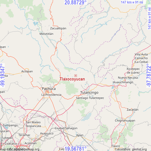
Tlaxocoyucan GPS coordinates[2]
20° 13' 44.22" North, 98° 29' 25.224" West
| Map corner | latitude | longitude |
|---|---|---|
| Upper-left | 20.88729°, | -99.19347° |
| Center: | 20.22895°, | -98.49034° |
| Lower-right: | 19.56781°, | -97.78722° |
| Map W x H: | 146.7×146.7 km | = 91.2×91.2mi |
| max Lat: | 32.7° ⇑37.9% North |
| Tlaxocoyucan: | 20.22895° |
| min Lat: | ⇓62.1% South 14.53588° |
| min Long | Tlaxocoyucan | max Long |
| -117.105° | -98.49034° | -86.73105° |
| W 57.4%⇐ | ⇒42.6% E |
Elevation
Elevation of Tlaxocoyucan is 2095 m = 6873 ft, and this is 841.3 m = 2760 ft above average elevation for this country.
| Max E: |
3497 m = 11473 ft | 21.7% |
| Tlaxocoyucan | 2095 m 6873 ft | |
| Avg. | 1253.7 m = 4113 ft | |
Min E: |
-1 m = -3 ft | 78.3% |
See also: Mexico elevation on elevation.city.
Geographical zone
Tlaxocoyucan is located in North Torrid zone (between Equator and Tropic of Cancer). Distance of this Northern Tropic circle is 356.7 km =221.6 mi to North.| Distance of | km | miles | from Tlaxocoyucan |
|---|---|---|---|
| North Pole | 7757.8 | 4820.5 | to North |
| Arctic Circle | 5151.9 | 3201.2 | to North |
| Tropic Cancer | 356.7 | 221.6 | to North |
| Equator | 2249.2 | 1397.6 | to South |


Nearby cities:
15 places around Tlaxocoyucan: (largest is in red/bold)
• Acatlán
10.7 km =6.6 mi,  150°
150°
• Alcholoya (El Salto de Alcholoya)
3.9 km =2.4 mi,  95°
95°
• Almoloya
9.7 km =6 mi, 153°
• Colonia Benito Juárez
11 km =6.8 mi,  156°
156°
• Encinillos
6.9 km =4.3 mi,  120°
120°
• Huasca de Ocampo
9.4 km =5.8 mi,  252°
252°
• La Loma
9.7 km =6 mi,  260°
260°
• Los Arcos
7.4 km =4.6 mi,  142°
142°
• Metepec Primero
11.4 km =7.1 mi, 147°
• Mixquiapan
9.6 km =6 mi,  175°
175°
• Río Seco Puente de Doria
2.3 km =1.4 mi,  208°
208°
• San Bartolo
3.8 km =2.4 mi,  46°
46°
• San Miguel Regla
7.4 km =4.6 mi, 261°
• Santo Domingo Agua Zarca
8.5 km =5.3 mi,  186°
186°
• Vicente Guerrero
10.3 km =6.4 mi,  105°
105°
Sources, notices
• [Note1] Compared only with cities in Mexico existing in our database
• [Src1] Map data: © OpenStreetMap contributors (CC-BY-SA)
• [Src2] Other city data from geonames.org with taken over terms of usage.
• [Src3] Geographical zone / Annual Mean Temperature by Robert A. Rohde @ Wikipedia
