Tlalnepantla geodata
Tlalnepantla (State of Mexico) is a populated place; located in Mexico in America/Mexico_City (GMT-6) time zone. With population of 653,410 people, there are 24 cities with bigger population in this country. Compared to other cities in Mexico, 53.3% of cities are located further ↑North; 52.7% of cities are located further →East and 85.1% of cities have lower elevation than Tlalnepantla. Note1


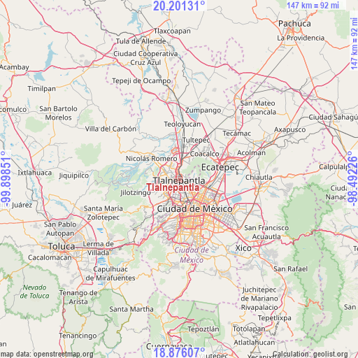
Tlalnepantla GPS coordinates[2]
19° 32' 24.18" North, 99° 11' 43.368" West
| Map corner | latitude | longitude |
|---|---|---|
| Upper-left | 20.20131°, | -99.89851° |
| Center: | 19.54005°, | -99.19538° |
| Lower-right: | 18.87607°, | -98.49226° |
| Map W x H: | 147.4×147.4 km | = 91.6×91.6mi |
| max Lat: | 32.7° ⇑53.3% North |
| Tlalnepantla: | 19.54005° |
| min Lat: | ⇓46.7% South 14.53588° |
| min Long | Tlalnepantla | max Long |
| -117.105° | -99.19538° | -86.73105° |
| W 47.3%⇐ | ⇒52.7% E |
Elevation
Elevation of Tlalnepantla is 2260 m = 7415 ft, and this is 1006.3 m = 3302 ft above average elevation for this country.
| Max E: |
3497 m = 11473 ft | 14.9% |
| Tlalnepantla | 2260 m 7415 ft | |
| Avg. | 1253.7 m = 4113 ft | |
Min E: |
-1 m = -3 ft | 85.1% |
See also: Tlalnepantla elevation on elevation.city.
Geographical zone
Tlalnepantla is located in North Torrid zone (between Equator and Tropic of Cancer). Distance of this Northern Tropic circle is 433.3 km =269.2 mi to North.| Distance of | km | miles | from Tlalnepantla |
|---|---|---|---|
| North Pole | 7834.4 | 4868.1 | to North |
| Arctic Circle | 5228.5 | 3248.8 | to North |
| Tropic Cancer | 433.3 | 269.2 | to North |
| Equator | 2172.6 | 1350 | to South |


Nearby cities:
15 places around Tlalnepantla: (largest is in red/bold)
• Ampliación San Mateo (Colonia Solidaridad)
9.9 km =6.2 mi,  30°
30°
• Ampliación el Tejocote
11.6 km =7.2 mi,  238°
238°
• Azcapotzalco
6 km =3.7 mi,  170°
170°
• Buenavista
8.1 km =5 mi,  19°
19°
• Ciudad López Mateos
6.7 km =4.2 mi,  287°
287°
• Colonia Lindavista
9.2 km =5.7 mi,  126°
126°
• Colonia Lázaro Cárdenas (Los Hornos)
11.1 km =6.9 mi, 23°
• Cuautitlán Izcalli
11.7 km =7.3 mi,  349°
349°
• Ejido del Tejocote
10.7 km =6.6 mi,  234°
234°
• Gustavo Adolfo Madero
10.2 km =6.3 mi,  120°
120°
• Naucalpan de Juárez
8.3 km =5.2 mi,  214°
214°
• Puerto Escondido (Tepeolulco Puerto Escondido)
10.3 km =6.4 mi,  82°
82°
• Rincón Verde
11.1 km =6.9 mi, 244°
• Sierra de Guadalupe
6.9 km =4.3 mi, 32°
• Vista Hermosa
4 km =2.5 mi, 227°
Sources, notices
• [Note1] Compared only with cities in Mexico existing in our database
• [Src1] Map data: © OpenStreetMap contributors (CC-BY-SA)
• [Src2] Other city data from geonames.org with taken over terms of usage.
• [Src3] Geographical zone / Annual Mean Temperature by Robert A. Rohde @ Wikipedia
