Vista Hermosa geodata
Vista Hermosa (State of Mexico) is a section of populated place; located in Mexico in America/Mexico_City (GMT-6) time zone. With population of 6,344 people, there are 1464 cities with bigger population in this country. Compared to other cities in Mexico, 53.7% of cities are located further ↑North; 53.2% of cities are located further →East and 86.5% of cities have lower elevation than Vista Hermosa. Note1


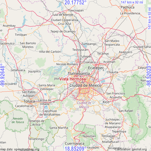
Vista Hermosa GPS coordinates[2]
19° 30' 58.176" North, 99° 13' 24.06" West
| Map corner | latitude | longitude |
|---|---|---|
| Upper-left | 20.17752°, | -99.92648° |
| Center: | 19.51616°, | -99.22335° |
| Lower-right: | 18.85209°, | -98.52023° |
| Map W x H: | 147.4×147.4 km | = 91.6×91.6mi |
| max Lat: | 32.7° ⇑53.7% North |
| Vista Hermosa: | 19.51616° |
| min Lat: | ⇓46.3% South 14.53588° |
| min Long | Vista Hermosa | max Long |
| -117.105° | -99.22335° | -86.73105° |
| W 46.8%⇐ | ⇒53.2% E |
Elevation
Elevation of Vista Hermosa is 2296 m = 7533 ft, and this is 1042.3 m = 3420 ft above average elevation for this country.
| Max E: |
3497 m = 11473 ft | 13.5% |
| Vista Hermosa | 2296 m 7533 ft | |
| Avg. | 1253.7 m = 4113 ft | |
Min E: |
-1 m = -3 ft | 86.5% |
See also: Mexico elevation on elevation.city.
Geographical zone
Vista Hermosa is located in North Torrid zone (between Equator and Tropic of Cancer). Distance of this Northern Tropic circle is 435.9 km =270.9 mi to North.| Distance of | km | miles | from Vista Hermosa |
|---|---|---|---|
| North Pole | 7837.1 | 4869.7 | to North |
| Arctic Circle | 5231.2 | 3250.5 | to North |
| Tropic Cancer | 435.9 | 270.9 | to North |
| Equator | 2170 | 1348.4 | to South |


Nearby cities:
15 places around Vista Hermosa: (largest is in red/bold)
• Ampliación el Tejocote
7.8 km =4.8 mi,  243°
243°
• Azcapotzalco
5.1 km =3.2 mi,  129°
129°
• Buenavista
11.7 km =7.3 mi,  28°
28°
• Ciudad López Mateos
5.8 km =3.6 mi,  322°
322°
• Colonia Lindavista
10.7 km =6.6 mi,  104°
104°
• Cuauhtémoc
11.3 km =7 mi, 134°
• Ejido del Tejocote
6.8 km =4.2 mi, 238°
• La Rosa
11.7 km =7.3 mi,  252°
252°
• Miguel Hidalgo
9.4 km =5.8 mi,  165°
165°
• Naucalpan de Juárez
4.5 km =2.8 mi,  202°
202°
• Polanco
9.6 km =6 mi,  164°
164°
• Puente de Piedra
9 km =5.6 mi,  255°
255°
• Rincón Verde
7.4 km =4.6 mi, 252°
• Sierra de Guadalupe
10.8 km =6.7 mi,  38°
38°
• Tlalnepantla
4 km =2.5 mi,  47°
47°
Sources, notices
• [Note1] Compared only with cities in Mexico existing in our database
• [Src1] Map data: © OpenStreetMap contributors (CC-BY-SA)
• [Src2] Other city data from geonames.org with taken over terms of usage.
• [Src3] Geographical zone / Annual Mean Temperature by Robert A. Rohde @ Wikipedia
