Teopisca geodata
Teopisca (Chiapas) is a seat of a second-order administrative division; located in Mexico in America/Mexico_City (GMT-6) time zone. With population of 16,240 people, there are 590 cities with bigger population in this country. Compared to other cities in Mexico, 94.1% of cities are located further ↑North; 92.1% of cities are located further ←West and 63.2% of cities have lower elevation than Teopisca. Note1


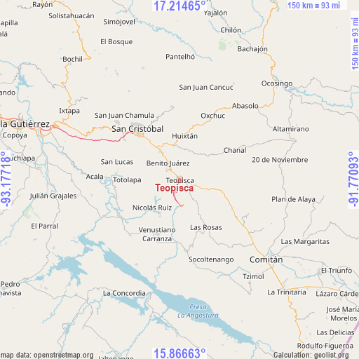
Teopisca GPS coordinates[2]
16° 32' 30.552" North, 92° 28' 26.58" West
| Map corner | latitude | longitude |
|---|---|---|
| Upper-left | 17.21465°, | -93.17718° |
| Center: | 16.54182°, | -92.47405° |
| Lower-right: | 15.86663°, | -91.77093° |
| Map W x H: | 149.9×149.9 km | = 93.1×93.1mi |
| max Lat: | 32.7° ⇑94.1% North |
| Teopisca: | 16.54182° |
| min Lat: | ⇓5.9% South 14.53588° |
| min Long | Teopisca | max Long |
| -117.105° | -92.47405° | -86.73105° |
| W 92.1%⇐ | ⇒7.9% E |
Elevation
Elevation of Teopisca is 1781 m = 5843 ft, and this is 527.3 m = 1730 ft above average elevation for this country.
| Max E: |
3497 m = 11473 ft | 36.8% |
| Teopisca | 1781 m 5843 ft | |
| Avg. | 1253.7 m = 4113 ft | |
Min E: |
-1 m = -3 ft | 63.2% |
See also: Mexico elevation on elevation.city.
Geographical zone
Teopisca is located in North Torrid zone (between Equator and Tropic of Cancer). Distance of this Northern Tropic circle is 766.6 km =476.3 mi to North.| Distance of | km | miles | from Teopisca |
|---|---|---|---|
| North Pole | 8167.8 | 5075.2 | to North |
| Arctic Circle | 5561.9 | 3456 | to North |
| Tropic Cancer | 766.6 | 476.3 | to North |
| Equator | 1839.3 | 1142.9 | to South |


Nearby cities:
15 places around Teopisca: (largest is in red/bold)
• Aguacatenango
10.3 km =6.4 mi,  137°
137°
• Amatenango del Valle
4.5 km =2.8 mi,  111°
111°
• Betania
8.8 km =5.5 mi,  324°
324°
• Campo Santiago
6.1 km =3.8 mi,  295°
295°
• Chijiltec (San Isidro)
6.1 km =3.8 mi,  285°
285°
• Dolores
8.2 km =5.1 mi,  327°
327°
• Dos Lagunas (San Isidro)
7.8 km =4.8 mi,  34°
34°
• El Madronal
5.1 km =3.2 mi,  127°
127°
• Galilea
8.5 km =5.3 mi, 333°
• Jardín del Nuevo Edén
7 km =4.3 mi, 322°
• Nuevo León
12.1 km =7.5 mi,  239°
239°
• Nuevo Zinacantán
8.5 km =5.3 mi, 324°
• San José Yashitinín
12.9 km =8 mi,  13°
13°
• Tzajalha
6.8 km =4.2 mi, 6°
• Vistahermosa
5.7 km =3.5 mi, 320°
Sources, notices
• [Note1] Compared only with cities in Mexico existing in our database
• [Src1] Map data: © OpenStreetMap contributors (CC-BY-SA)
• [Src2] Other city data from geonames.org with taken over terms of usage.
• [Src3] Geographical zone / Annual Mean Temperature by Robert A. Rohde @ Wikipedia
