San José Yashitinín geodata
San José Yashitinín (Chiapas) is a populated place; located in Mexico in America/Mexico_City (GMT-6) time zone. With population of 1,109 people, there are 7837 cities with bigger population in this country. Compared to other cities in Mexico, 93.2% of cities are located further ↑North; 92.3% of cities are located further ←West and 88.5% of cities have lower elevation than San José Yashitinín. Note1


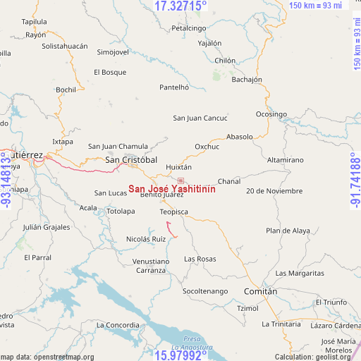
San José Yashitinín GPS coordinates[2]
16° 39' 16.992" North, 92° 26' 42" West
| Map corner | latitude | longitude |
|---|---|---|
| Upper-left | 17.32715°, | -93.14813° |
| Center: | 16.65472°, | -92.445° |
| Lower-right: | 15.97992°, | -91.74188° |
| Map W x H: | 149.8×149.8 km | = 93.1×93.1mi |
| max Lat: | 32.7° ⇑93.2% North |
| San José Yashitinín: | 16.65472° |
| min Lat: | ⇓6.8% South 14.53588° |
| min Long | San José Yashi | max Long |
| -117.105° | -92.445° | -86.73105° |
| W 92.3%⇐ | ⇒7.7% E |
Elevation
Elevation of San José Yashitinín is 2358 m = 7736 ft, and this is 1104.3 m = 3623 ft above average elevation for this country.
| Max E: |
3497 m = 11473 ft | 11.5% |
| San José Yashitinín | 2358 m 7736 ft | |
| Avg. | 1253.7 m = 4113 ft | |
Min E: |
-1 m = -3 ft | 88.5% |
See also: Mexico elevation on elevation.city.
Geographical zone
San José Yashitinín is located in North Torrid zone (between Equator and Tropic of Cancer). Distance of this Northern Tropic circle is 754.1 km =468.6 mi to North.| Distance of | km | miles | from San José Yashitinín |
|---|---|---|---|
| North Pole | 8155.2 | 5067.4 | to North |
| Arctic Circle | 5549.3 | 3448.2 | to North |
| Tropic Cancer | 754.1 | 468.6 | to North |
| Equator | 1851.8 | 1150.7 | to South |


Nearby cities:
15 places around San José Yashitinín: (largest is in red/bold)
• Buenavista
1.9 km =1.2 mi,  45°
45°
• Carmen Yalchuch
8.9 km =5.5 mi,  97°
97°
• Chanal
8.4 km =5.2 mi,  34°
34°
• Dolores
9.3 km =5.8 mi,  233°
233°
• Dos Lagunas (San Isidro)
6.3 km =3.9 mi,  167°
167°
• Eshpuilho
7 km =4.3 mi,  332°
332°
• Galilea
8.5 km =5.3 mi, 234°
• Huixtán
6.3 km =3.9 mi,  352°
352°
• La Soledad
8.3 km =5.2 mi,  286°
286°
• Los Pozos
4.1 km =2.5 mi, 100°
• Lázaro Cárdenas (Chilil)
5.3 km =3.3 mi,  296°
296°
• Oquem
8.5 km =5.3 mi,  335°
335°
• San Andrés Puerto Rico
6.7 km =4.2 mi,  42°
42°
• San Gregorio de las Casas
7 km =4.3 mi,  58°
58°
• Tzajalha
6.3 km =3.9 mi,  202°
202°
Sources, notices
• [Note1] Compared only with cities in Mexico existing in our database
• [Src1] Map data: © OpenStreetMap contributors (CC-BY-SA)
• [Src2] Other city data from geonames.org with taken over terms of usage.
• [Src3] Geographical zone / Annual Mean Temperature by Robert A. Rohde @ Wikipedia
