Galilea geodata
Galilea (Chiapas) is a populated place; located in Mexico in America/Mexico_City (GMT-6) time zone. With population of 569 people, there are 15027 cities with bigger population in this country. Compared to other cities in Mexico, 93.5% of cities are located further ↑North; 91.8% of cities are located further ←West and 86.3% of cities have lower elevation than Galilea. Note1


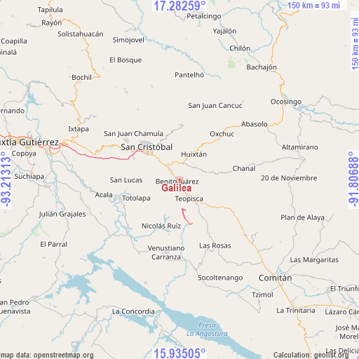
Galilea GPS coordinates[2]
16° 36' 36" North, 92° 30' 36" West
| Map corner | latitude | longitude |
|---|---|---|
| Upper-left | 17.28259°, | -93.21313° |
| Center: | 16.61°, | -92.51° |
| Lower-right: | 15.93505°, | -91.80688° |
| Map W x H: | 149.8×149.8 km | = 93.1×93.1mi |
| max Lat: | 32.7° ⇑93.5% North |
| Galilea: | 16.61° |
| min Lat: | ⇓6.5% South 14.53588° |
| min Long | Galilea | max Long |
| -117.105° | -92.51° | -86.73105° |
| W 91.8%⇐ | ⇒8.2% E |
Elevation
Elevation of Galilea is 2288 m = 7507 ft, and this is 1034.3 m = 3393 ft above average elevation for this country.
| Max E: |
3497 m = 11473 ft | 13.7% |
| Galilea | 2288 m 7507 ft | |
| Avg. | 1253.7 m = 4113 ft | |
Min E: |
-1 m = -3 ft | 86.3% |
See also: Mexico elevation on elevation.city.
Geographical zone
Galilea is located in North Torrid zone (between Equator and Tropic of Cancer). Distance of this Northern Tropic circle is 759.1 km =471.7 mi to North.| Distance of | km | miles | from Galilea |
|---|---|---|---|
| North Pole | 8160.2 | 5070.5 | to North |
| Arctic Circle | 5554.3 | 3451.3 | to North |
| Tropic Cancer | 759.1 | 471.7 | to North |
| Equator | 1846.9 | 1147.6 | to South |


Nearby cities:
15 places around Galilea: (largest is in red/bold)
• Betania
1.3 km =0.8 mi,  252°
252°
• Campo Santiago
5.2 km =3.2 mi,  198°
198°
• Chijiltec (San Isidro)
6.3 km =3.9 mi, 198°
• Corazón de María
10.3 km =6.4 mi,  345°
345°
• Dolores
0.8 km =0.5 mi,  220°
220°
• Dos Lagunas (San Isidro)
8.4 km =5.2 mi,  98°
98°
• Jardín del Nuevo Edén
2.1 km =1.3 mi,  191°
191°
• La Soledad
7.5 km =4.7 mi, 352°
• Lázaro Cárdenas (Chilil)
7.7 km =4.8 mi,  16°
16°
• Mitzitón
5.4 km =3.4 mi,  318°
318°
• Nuevo Zinacantán
1.3 km =0.8 mi,  240°
240°
• San José Yashitinín
8.5 km =5.3 mi,  54°
54°
• Teopisca
8.5 km =5.3 mi,  153°
153°
• Tzajalha
4.6 km =2.9 mi, 100°
• Vistahermosa
3.2 km =2 mi,  175°
175°
Sources, notices
• [Note1] Compared only with cities in Mexico existing in our database
• [Src1] Map data: © OpenStreetMap contributors (CC-BY-SA)
• [Src2] Other city data from geonames.org with taken over terms of usage.
• [Src3] Geographical zone / Annual Mean Temperature by Robert A. Rohde @ Wikipedia
