Santa María Ecatepec geodata
Santa María Ecatepec (Oaxaca) is a seat of a second-order administrative division; located in Mexico in America/Mexico_City (GMT-6) time zone. With population of 524 people, there are 16113 cities with bigger population in this country. Compared to other cities in Mexico, 95.8% of cities are located further ↑North; 82.5% of cities are located further ←West and 65% of cities have lower elevation than Santa María Ecatepec. Note1
Current local time in Santa María Ecatepec:
06:53 AM, WednesdayDifference from your time zone: hours


Santa María Ecatepec GPS coordinates[2]
16° 17' 5.928" North, 95° 52' 47.892" West
| Map corner | latitude | longitude |
|---|---|---|
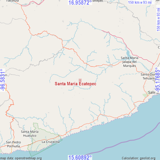
| Upper-left | 16.95872°, | -96.5831° |
| Center: | 16.28498°, | -95.87997° |
| Lower-right: | 15.60892°, | -95.17685° |
| Map W x H: | 150.1×150.1 km | = 93.3×93.3mi |
| max Lat: | 32.7° ⇑95.8% North |
| Santa María Ecatepec: | 16.28498° |
| min Lat: | ⇓4.2% South 14.53588° |
| min Long | Santa María Ec | max Long |
| -117.105° | -95.87997° | -86.73105° |
| W 82.5%⇐ | ⇒17.5% E |
Elevation
Elevation of Santa María Ecatepec is 1830 m = 6004 ft, and this is 576.3 m = 1891 ft above average elevation for this country.
| Max E: |
3497 m = 11473 ft | 35% |
| Santa María Ecatepec | 1830 m 6004 ft | |
| Avg. | 1253.7 m = 4113 ft | |
Min E: |
-1 m = -3 ft | 65% |
See also: Mexico elevation on elevation.city.
Geographical zone
Santa María Ecatepec is located in North Torrid zone (between Equator and Tropic of Cancer). Distance of this Northern Tropic circle is 795.2 km =494.1 mi to North.| Distance of | km | miles | from Santa María Ecatepec |
|---|---|---|---|
| North Pole | 8196.3 | 5092.9 | to North |
| Arctic Circle | 5590.5 | 3473.8 | to North |
| Tropic Cancer | 795.2 | 494.1 | to North |
| Equator | 1810.7 | 1125.1 | to South |


Nearby cities:
15 places around Santa María Ecatepec: (largest is in red/bold)
• Asunción Tlacolulita
16.4 km =10.2 mi,  84°
84°
• Guadalupe Victoria
29.9 km =18.6 mi,  181°
181°
• Magdalena Tequisistlán
32.3 km =20.1 mi,  66°
66°
• Merced del Potrero
33.4 km =20.8 mi,  217°
217°
• San Bartolo Yautepec
19 km =11.8 mi,  327°
327°
• San Francisco Guichina
31.9 km =19.8 mi,  310°
310°
• San Isidro Chihuiro
30.6 km =19 mi, 326°
• San Matías Petacaltepec
12.4 km =7.7 mi, 183°
• San Miguel Ecatepec
13.6 km =8.5 mi,  101°
101°
• San Miguel Tenango
30.5 km =19 mi,  93°
93°
• San Pablo Topiltepec
19.3 km =12 mi,  232°
232°
• San Pedro Leapi
27 km =16.8 mi,  281°
281°
• Santa María Quiegolani
18.5 km =11.5 mi,  267°
267°
• Santa María Zapotitlán
17.7 km =11 mi,  170°
170°
• Santo Tomás Quieri
32.9 km =20.4 mi, 282°
Sources, notices
• [Note1] Compared only with cities in Mexico existing in our database
• [Src1] Map data: © OpenStreetMap contributors (CC-BY-SA)
• [Src2] Other city data from geonames.org with taken over terms of usage.
• [Src3] Geographical zone / Annual Mean Temperature by Robert A. Rohde @ Wikipedia
