San Matías Petacaltepec geodata
San Matías Petacaltepec (Oaxaca) is a populated place; located in Mexico in America/Mexico_City (GMT-6) time zone. With population of 696 people, there are 12503 cities with bigger population in this country. Compared to other cities in Mexico, 96.5% of cities are located further ↑North; 82.5% of cities are located further ←West and 51.8% of cities have lower elevation than San Matías Petacaltepec. Note1
Current local time in San Matías Petacaltepec:
08:32 AM, WednesdayDifference from your time zone: hours


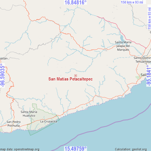
San Matías Petacaltepec GPS coordinates[2]
16° 10' 26.508" North, 95° 53' 13.992" West
| Map corner | latitude | longitude |
|---|---|---|
| Upper-left | 16.84816°, | -96.59035° |
| Center: | 16.17403°, | -95.88722° |
| Lower-right: | 15.49759°, | -95.1841° |
| Map W x H: | 150.2×150.2 km | = 93.3×93.3mi |
| max Lat: | 32.7° ⇑96.5% North |
| San Matías Petacaltepec: | 16.17403° |
| min Lat: | ⇓3.5% South 14.53588° |
| min Long | San Matías Pet | max Long |
| -117.105° | -95.88722° | -86.73105° |
| W 82.5%⇐ | ⇒17.5% E |
Elevation
Elevation of San Matías Petacaltepec is 1518 m = 4980 ft, and this is 264.3 m = 867 ft above average elevation for this country.
| Max E: |
3497 m = 11473 ft | 48.2% |
| San Matías Petacaltepec | 1518 m 4980 ft | |
| Avg. | 1253.7 m = 4113 ft | |
Min E: |
-1 m = -3 ft | 51.8% |
See also: Mexico elevation on elevation.city.
Geographical zone
San Matías Petacaltepec is located in North Torrid zone (between Equator and Tropic of Cancer). Distance of this Northern Tropic circle is 807.5 km =501.8 mi to North.| Distance of | km | miles | from San Matías Petacaltepec |
|---|---|---|---|
| North Pole | 8208.7 | 5100.6 | to North |
| Arctic Circle | 5602.8 | 3481.4 | to North |
| Tropic Cancer | 807.5 | 501.8 | to North |
| Equator | 1798.4 | 1117.5 | to South |


Nearby cities:
15 places around San Matías Petacaltepec: (largest is in red/bold)
• Asunción Tlacolulita
22.1 km =13.7 mi,  50°
50°
• El Coyul
30 km =18.6 mi,  164°
164°
• Guadalupe Victoria
17.6 km =10.9 mi,  180°
180°
• Merced del Potrero
24.2 km =15 mi,  234°
234°
• Río Seco
30.1 km =18.7 mi,  151°
151°
• San Bartolo Yautepec
29.9 km =18.6 mi,  341°
341°
• San Miguel Ecatepec
17 km =10.6 mi,  55°
55°
• San Pablo Topiltepec
14.6 km =9.1 mi,  272°
272°
• San Pedro Huamelula
28.6 km =17.8 mi,  124°
124°
• Santa María Ecatepec
12.4 km =7.7 mi,  3°
3°
• Santa María Huamelula
28.1 km =17.5 mi,  135°
135°
• Santa María Petatengo
26.9 km =16.7 mi,  211°
211°
• Santa María Quiegolani
21.1 km =13.1 mi,  302°
302°
• Santa María Zapotitlán
6.3 km =3.9 mi, 144°
• Tapanalá
28.9 km =18 mi, 143°
Sources, notices
• [Note1] Compared only with cities in Mexico existing in our database
• [Src1] Map data: © OpenStreetMap contributors (CC-BY-SA)
• [Src2] Other city data from geonames.org with taken over terms of usage.
• [Src3] Geographical zone / Annual Mean Temperature by Robert A. Rohde @ Wikipedia
